Palmer Land
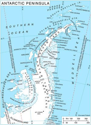
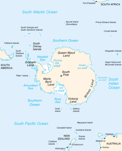
Palmer Land (71°30′S 065°00′W / 71.500°S 65.000°WCoordinates: 71°30′S 065°00′W / 71.500°S 65.000°W) is that portion of the Antarctic Peninsula, Antarctica that lies south of a line joining Cape Jeremy and Cape Agassiz. This application of Palmer Land is consistent with the 1964 agreement between US-ACAN and UK-APC, in which the name Antarctic Peninsula was approved for the major peninsula of Antarctica, and the names Graham Land and Palmer Land for the northern and southern portions, respectively.


.
Boundaries
In its southern extreme, the Antarctic Peninsula stretches west, with Palmer Land eventually bordering Ellsworth Land along the 80° W line of longitude. Palmer Land is bounded in the south by the ice-covered Carlson Inlet, an arm of the Filchner Ice Shelf, which crosses the 80° W line. This is the base of Cetus Hill.
This feature is named after Captain Nathaniel B. Palmer; an American sealer who explored the Antarctic Peninsula area southward of Deception Island in the sloop Hero in November, 1820.[1]
Features
- Aldebaran Rock (70°50′S 66°41′W / 70.833°S 66.683°W) is a particularly conspicuous nunatak of bright red rock, located near the head of Bertram Glacier and 5 miles (8 km) northeast of Pegasus Mountains in western Palmer Land. Named by United Kingdom Antarctic Place-Names Committee after Aldebaran, an orange-colored star that is the brightest in the constellation of Taurus.
References
- ↑ Howgego, Raymond (2004). Encyclopedia of Exploration (Part 2: 1800 to 1850). Potts Point, NSW, Australia: Hordern House.