Palo Verde Airport
| Palo Verde Airport Aeropuerto Nacional Palo Verde | |||||||||||
|---|---|---|---|---|---|---|---|---|---|---|---|
| IATA: SRL – ICAO: none | |||||||||||
| Summary | |||||||||||
| Airport type | Public | ||||||||||
| Serves | Santa Rosalía | ||||||||||
| Location |
Mulegé Municipality, Baja California Sur, Mexico | ||||||||||
| Elevation AMSL | 55 ft / 17 m | ||||||||||
| Coordinates | 27°05′35″N 112°05′56″W / 27.09306°N 112.09889°WCoordinates: 27°05′35″N 112°05′56″W / 27.09306°N 112.09889°W | ||||||||||
| Map | |||||||||||
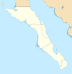 SRL Location of airport in Baja California Sur | |||||||||||
| Runways | |||||||||||
| |||||||||||
| Statistics (2014) | |||||||||||
| |||||||||||
|
Source: Dirección General de Aeronáutica Civil | |||||||||||
Palo Verde Airport (IATA: SRL) is a paved airstrip located in San Bruno, a town 30 km south of Santa Rosalía, Baja California Sur, Mexico. The airstrip is also known as "Chivato Bay" and the CIB code is used as its identifier. It handles aviation for the city of Santa Rosalía.
Airlines and destinations
| Airlines | Destinations |
|---|---|
| Aéreo Servicio Guerrero | Guaymas, Guerrero Negro, Hermosillo |
External links
- Fallingrain.com: SRL—Palo Verde Airport
- Baja-web.com: Info about Palo Verde Airstrip.
- Mulege.net: Photo of the airstrip office.
This article is issued from Wikipedia - version of the 11/27/2016. The text is available under the Creative Commons Attribution/Share Alike but additional terms may apply for the media files.