Parsberg
| Parsberg | ||
|---|---|---|
| ||
 Parsberg | ||
Location of Parsberg within Neumarkt in der Oberpfalz district 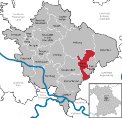 | ||
| Coordinates: 49°9′N 11°43′E / 49.150°N 11.717°ECoordinates: 49°9′N 11°43′E / 49.150°N 11.717°E | ||
| Country | Germany | |
| State | Bavaria | |
| Admin. region | Oberpfalz | |
| District | Neumarkt in der Oberpfalz | |
| Government | ||
| • Mayor | Josef Bauer (CSU) | |
| Area | ||
| • Total | 57.00 km2 (22.01 sq mi) | |
| Population (2015-12-31)[1] | ||
| • Total | 6,771 | |
| • Density | 120/km2 (310/sq mi) | |
| Time zone | CET/CEST (UTC+1/+2) | |
| Postal codes | 92331 | |
| Dialling codes | 09492 | |
| Vehicle registration | NM, PAR | |
| Website | www.parsberg.de | |

Parsberg is a town in the county of Neumarkt in Bavaria, Germany. It is situated 23 km southeast of Neumarkt in der Oberpfalz, and 33 km northwest of Regensburg, next to the A3 autobahn, the main route from Nuremberg to Regensburg (and then on into Austria). It was formerly the seat of the Counts of Parsberg, whose coat of arms is now used by the town.
Sightseeing
Parsberg Castle and museum (the museum is only open on Sundays or by appointment). Parsberg also has a beautiful medieval church. The city of Lupburg and the U.S. Army installation at Hohenfels are nearby, as is the lovely Altmuhl river valley. In addition, there are numerous castles and ruins are in the area.
Services
Parsberg has a regional hospital and is served by the Deutsche Bahn at its railway station, with routine service to nearby large cities.
Clubs
- The Society for Creative Anachronism has a local branch, the Stronghold of Nebelwald, which stretches from Parsberg in the far south to Vilseck in the north.
- The U.S. Field Artillery Association has a local chapter at Hohenfels, which includes the town of Parsberg.
Churches
- Like all of Bavaria, the town is predominantly Roman Catholic; however, Protestant churches are also well represented.
- Americans in the Church of Jesus Christ of Latter-day Saints living in Parsberg belong to the Regensburg Branch of the Nuremberg Stake.
External links
- History of Parsberg (pdf in German)
- History of the Coat of Arms of Parsberg
References
- ↑ "Fortschreibung des Bevölkerungsstandes". Bayerisches Landesamt für Statistik und Datenverarbeitung (in German). June 2016.
Towns and municipalities in Neumarkt | ||
|---|---|---|