Paternion
| Paternion | ||
|---|---|---|
|
St. Paternian Church | ||
| ||
 Paternion Location within Austria | ||
| Coordinates: 46°43′N 13°38′E / 46.717°N 13.633°ECoordinates: 46°43′N 13°38′E / 46.717°N 13.633°E | ||
| Country | Austria | |
| State | Carinthia | |
| District | Villach-Land | |
| Government | ||
| • Mayor | Alfons Arnold (SPÖ) | |
| Area | ||
| • Total | 105.5 km2 (40.7 sq mi) | |
| Elevation | 519 m (1,703 ft) | |
| Population (1 January 2016)[1] | ||
| • Total | 5,877 | |
| • Density | 56/km2 (140/sq mi) | |
| Time zone | CET (UTC+1) | |
| • Summer (DST) | CEST (UTC+2) | |
| Postal code | 9711 | |
| Area code | 04245 | |
| Website | www.paternion.at | |

Paternion (Slovene: Špaterjan) is a market town in the district of Villach-Land in the Austrian state of Carinthia. It is located within the Drava valley about 18 kilometres (11 mi) in the north-west of the city of Villach.
Geography
Paternion is subdivided into six Katastralgemeinden: Feistritz an der Drau, Kamering, Kreuzen, Nikelsdorf, Paternion and Rubland.
History
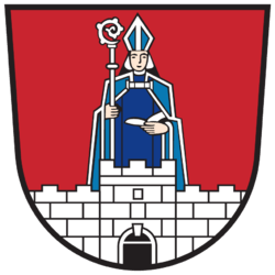
Settled since the Hallstatt culture, the place was first mentioned as St. Paternianus in a 1296 deed, named after Saint Paternian, the Bishop of Fano, as the area south of the Drava then belonged to the Patriarchate of Aquileia.[2] In 1530 Paternion received market rights from Archduke Ferdinand I of Austria. With a percentage of about 30%, the municipality is today one of the centres of Protestantism in Carinthia.
Politics
Seats in the municipal assembly (Gemeinderat) as of 2009 elections:
- Social Democratic Party of Austria (SPÖ): 13
- Alliance for the Future of Austria (BZÖ): 8
- Bürgerliste (Independent): 6
Twin town
References
External links
![]() Media related to Paternion at Wikimedia Commons
Media related to Paternion at Wikimedia Commons