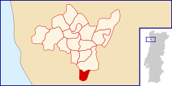
Pedrouços
| Pedrouços | ||
|---|---|---|
| Parish | ||
| ||
 | ||
| Coordinates: 41°11′10″N 8°35′20″W / 41.186°N 8.589°WCoordinates: 41°11′10″N 8°35′20″W / 41.186°N 8.589°W | ||
| Country | Portugal | |
| Municipality | Maia | |
| Area | ||
| • Total | 2.57 km2 (0.99 sq mi) | |
| Population (2011) | ||
| • Total | 12,149 | |
| • Density | 4,700/km2 (12,000/sq mi) | |
| Postal code | 4425 | |
| Website | http://www.jf-pedroucos.pt/ | |
Pedrouços is a Portuguese parish located in the municipality of Maia. The population in 2011 was 12,149,[1] in an area of 2.57 km².[2]
The place of Pedrouços was the most important and populous of the Águas Santas parish. As an autonomous religious parish it exists since 1928, but the civil parish status (Freguesia) was only given to it in 1985.
References
This article is issued from Wikipedia - version of the 11/7/2015. The text is available under the Creative Commons Attribution/Share Alike but additional terms may apply for the media files.
