Pic de Bure
| Pic de Bure | |
|---|---|
 Pic de Bure | |
| Highest point | |
| Elevation | 2,709 m (8,888 ft) |
| Prominence | 1,268 m (4,160 ft) [1] |
| Coordinates | 44°37′37″N 5°56′06″E / 44.62694°N 5.93500°ECoordinates: 44°37′37″N 5°56′06″E / 44.62694°N 5.93500°E [2] |
| Geography | |
 Pic de Bure | |
| Parent range | Dauphiné Alps |
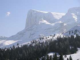
Pic de Bure is a prominent mountain of the Dauphiné Alps in France, culminating at a height of 2,709 m (8,888 ft), the third highest peak of the Dévoluy Mountains. The Plateau de Bure Interferometer is located on its slopes.
Notes
- ↑ "Pic de Bure". Peakbagger.com. Retrieved 20 January 2015.
- ↑ Source : Géoportail avec carte IGN à l'échelle 1:25000
This article is issued from Wikipedia - version of the 11/11/2015. The text is available under the Creative Commons Attribution/Share Alike but additional terms may apply for the media files.