Pinega
| Pinega (English) Пинега (Russian) | |
|---|---|
|
- Rural locality[1] - Settlement[1] | |
|
| |
.svg.png) Location of Arkhangelsk Oblast in Russia | |
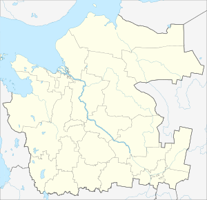 Pinega | |
|
| |
_(1780).png) | |
|
| |
| Administrative status | |
| Country | Russia |
| Federal subject | Arkhangelsk Oblast |
| Administrative district | Pinezhsky District[1] |
| Selsoviet | Pinezhsky Selsoviet[1] |
| Administrative center of | Pinezhsky Selsoviet[1] |
| Municipal status (as of February 2010) | |
| Municipal district | Pinezhsky Municipal District[2] |
| Rural settlement | Pinezhskoye Rural Settlement[2] |
| Administrative center of | Pinezhskoye Rural Settlement[2] |
| Statistics | |
| Population (2010 Census) | 3,225 inhabitants[3] |
| Time zone | MSK (UTC+03:00)[4] |
Pinega (Russian: Пинега) is a rural locality (a settlement), formerly a town, in Pinezhsky District of Arkhangelsk Oblast, Russia, located on the right bank of the Pinega River (hence the name). It serves as the administrative center of Pinezhsky Selsoviet, one of the seventeen selsoviets into which the district is administratively divided. Municipally, it is the administrative center of Pinezhskoye Rural Settlement, one of the fifteen rural settlements in the district. Population: 3,225 (2010 Census);[3] 3,763 (2002 Census);[5] 4,401 (1989 Census).[6].
History
Pinega was known from 17th century as the pogost of Pinezhsky Volok. In the course of the administrative reform performed in 1708 by Peter the Great the area was included into Archangelgorod Governorate, with the creation of Kevrolsky Uyezd. The center of the uyezd was located in Kevrola, now a village. In 1780, the Governorate was abolished and transformed into Vologda Viceroyalty, with the creation of Pinezhsky Uyezd in place of the Kevrolsky Uyezd. The center of the uyezd was Pinega, which thereby became a town. In 1796, Pinezhsky Uyezd moved into the Arkhangelsk Governorate. In 1897, the population of Pinega was 992.[7] In 1925 the town of Pinega, while still being the center of the uyezd, was downgraded to a selo, and in February 1927, Pinezhsky Uyezd was abolished and merged into Arkhangelsky Uyezd.
During Russian Civil War in 1918, battles were fought between the Red Army and British troops in Pinega and around. For a short period, Pinega was occupied by British and American troops.
In 1929, several governorates were merged into Northern Krai. July 15, 1929 the uyezds were abolished, and Pinezhsky District was established. Pinezhsky District became a part of the Arkhangelsk Okrug of the Northern Krai. In 1930, the Okrug was abolished, and the district became subordinate to the central administration of the Northern Krai. In 1936, the Krai was transformed into Northern Oblast. In 1937, Northern Oblast was split into Arkhangelsk Oblast and Vologda Oblast. Then, in 1959, Karpogorsky and Pinezhsky Districts were merged into one district with the administrative center located in Karpogory.[8][9]
From 1960 to 1993 Pinega was an urban-type settlement, after which it was downgraded to a rural type settlement again.[7]
Economy
Transportation
The Pinega River is navigable below the village of Sogra, although there is no regular passenger navigation. Pinega is located at the point where the river sharply turns south-west. At this point, it passes several kilometers from the course of the Kuloy River. In 1926—1928 a canal connecting the Pinega with the Kuloy was constructed, however, currently the canal is pretty much neglected.
An important road (unpaved) along the right bank of the Pinega connects Arkhangelsk with the valley of the Mezen. From this road, another one, also unpaved, branches off and follows the Pinega to Karpogory, the village of Zanyukhcha, and then crosses the border with the Komi Republic to the timber production settlements.
Culture and recreation
15 kilometers (9.3 mi) from Pinega, in the village of Maletino, there is Krasnogorsky Monastery which is classified as cultural and historical heritage by Russian Federal law.[10] The monastery is neglected.[11]
The District Museum of the Pinezhsky District is located in Pinega.[12]
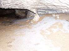
Downstream from Pinega there are karst caves which are a major tourist attraction. The karst landscape of the right bank of the Pinega River is protected in Pinezhsky Nature Reserve.
References
Notes
- 1 2 3 4 5 Государственный комитет Российской Федерации по статистике. Комитет Российской Федерации по стандартизации, метрологии и сертификации. №ОК 019-95 1 января 1997 г. «Общероссийский классификатор объектов административно-территориального деления. Код 11 248 827 007», в ред. изменения №259/2014 от 12 декабря 2014 г.. (State Statistics Committee of the Russian Federation. Committee of the Russian Federation on Standardization, Metrology, and Certification. #OK 019-95 January 1, 1997 Russian Classification of Objects of Administrative Division . Code 11 248 827 007, as amended by the Amendment #259/2014 of December 12, 2014. ).
- 1 2 3 Архангельское областное Собрание депутатов. Областной закон №258-внеоч.-ОЗ от 23 сентября 2004 г. «О статусе и границах территорий муниципальных образований в Архангельской области», в ред. Областного закона №224-13-ОЗ от 16 декабря 2014 г. «Об упразднении отдельных населённых пунктов Соловецкого района Архангельской области и о внесении изменения в статью 46 Областного закона "О статусе и границах территорий муниципальных образований в Архангельской области"». Вступил в силу со дня официального опубликования. Опубликован: "Волна", №38, 8 октября 2004 г. (Arkhangelsk Oblast Council of Deputies. Oblast Law #258-vneoch.-OZ of September 23, 2004 On the Status and Borders of the Territories of the Municipal Formations in Arkhangelsk Oblast, as amended by the Oblast Law #224-13-OZ of December 16, 2014 On Abolishing Several Inhabited Localities in Solovetsky District of Arkhangelsk Oblast and on Amending Article 46 of the Oblast Law "On the Status and Borders of the Territories of the Municipal Formations in Arkhangelsk Oblast". Effective as of the day of the official publication.).
- 1 2 Russian Federal State Statistics Service (2011). "Всероссийская перепись населения 2010 года. Том 1" [2010 All-Russian Population Census, vol. 1]. Всероссийская перепись населения 2010 года (2010 All-Russia Population Census) (in Russian). Federal State Statistics Service. Retrieved June 29, 2012.
- ↑ Правительство Российской Федерации. Федеральный закон №107-ФЗ от 3 июня 2011 г. «Об исчислении времени», в ред. Федерального закона №271-ФЗ от 03 июля 2016 г. «О внесении изменений в Федеральный закон "Об исчислении времени"». Вступил в силу по истечении шестидесяти дней после дня официального опубликования (6 августа 2011 г.). Опубликован: "Российская газета", №120, 6 июня 2011 г. (Government of the Russian Federation. Federal Law #107-FZ of June 31, 2011 On Calculating Time, as amended by the Federal Law #271-FZ of July 03, 2016 On Amending Federal Law "On Calculating Time". Effective as of after sixty days following the day of the official publication.).
- ↑ Russian Federal State Statistics Service (May 21, 2004). "Численность населения России, субъектов Российской Федерации в составе федеральных округов, районов, городских поселений, сельских населённых пунктов – районных центров и сельских населённых пунктов с населением 3 тысячи и более человек" [Population of Russia, Its Federal Districts, Federal Subjects, Districts, Urban Localities, Rural Localities—Administrative Centers, and Rural Localities with Population of Over 3,000] (XLS). Всероссийская перепись населения 2002 года [All-Russia Population Census of 2002] (in Russian). Retrieved August 9, 2014.
- ↑ Demoscope Weekly (1989). "Всесоюзная перепись населения 1989 г. Численность наличного населения союзных и автономных республик, автономных областей и округов, краёв, областей, районов, городских поселений и сёл-райцентров" [All Union Population Census of 1989: Present Population of Union and Autonomous Republics, Autonomous Oblasts and Okrugs, Krais, Oblasts, Districts, Urban Settlements, and Villages Serving as District Administrative Centers]. Всесоюзная перепись населения 1989 года [All-Union Population Census of 1989] (in Russian). Институт демографии Национального исследовательского университета: Высшая школа экономики [Institute of Demography at the National Research University: Higher School of Economics]. Retrieved August 9, 2014.
- 1 2 Энциклопедия Города России. Moscow: Большая Российская Энциклопедия. 2003. p. 548. ISBN 5-7107-7399-9.
- ↑ "АДМИНИСТРАТИВНО-ТЕРРИТОРИАЛЬНОЕ ДЕЛЕНИЕ АРХАНГЕЛЬСКОЙ ГУБЕРНИИ В XVIII-XX вв. * (СПРАВКА)" (in Russian). Архивы России. 2000. Retrieved 27 July 2011.
- ↑ Пинежский муниципальный район (in Russian). Администрация МО Пинежский район. Retrieved 1 August 2011.
- ↑ Памятники истории и культуры народов Российской Федерации (in Russian). Russian Ministry of Culture. Retrieved 2 June 2016.
- ↑ Красногорский Богородицкий монастырь (in Russian). Mirny: Мир Информации и Рекламы. Retrieved 2 August 2011.
- ↑ Пинежский краеведческий музей (in Russian). Российская сеть культурного наследия. Retrieved August 2, 2011.
Sources
- Архангельское областное Собрание депутатов. Областной закон №65-5-ОЗ от 23 сентября 2009 г. «Об административно-территориальном устройстве Архангельской области», в ред. Областного закона №232-13-ОЗ от 16 декабря 2014 г. «О внесении изменений в отдельные Областные Законы в сфере осуществления местного самоуправления и взаимодействия с некоммерческими организациями». Вступил в силу через десять дней со дня официального опубликования. Опубликован: "Волна", №43, 6 октября 2009 г. (Arkhangelsk Oblast Council of Deputies. Oblast Law #65-5-OZ of September 23, 2009 On the Administrative-Territorial Structure of Arkhangelsk Oblast, as amended by the Oblast Law #232-13-OZ of December 16, 2014 On Amending Various Oblast Laws Dealing with the Process of Municipal Self-Government and Relations with Non-Profit Organizations. Effective as of the day which is ten days after the official publication.).