Pitt River
| Pitt River | |
 Pitt River, looking north from the Lougheed highway bridge in Port Coquitlam | |
| Country | Canada |
|---|---|
| Province | British Columbia |
| Tributaries | |
| - left | Alouette River |
| Source | Garibaldi Ranges |
| Mouth | Fraser River |
| - location | Pitt Meadows, Port Coquitlam, Greater Vancouver Regional District |
| - elevation | 5 m (16 ft) [1] |
| - coordinates | 49°13′43″N 122°46′4″W / 49.22861°N 122.76778°WCoordinates: 49°13′43″N 122°46′4″W / 49.22861°N 122.76778°W [2] |
| Discharge | for Alvin |
| - average | 54.0 m3/s (1,907 cu ft/s) [3] |
| - max | 597 m3/s (21,083 cu ft/s) |
| - min | 5.10 m3/s (180 cu ft/s) |
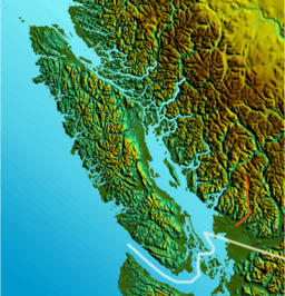 Location of Pitt River | |
The Pitt River in British Columbia, Canada is a large tributary of the Fraser River, entering it a few miles upstream from New Westminster and about 25 km ESE of Downtown Vancouver. The river, which begins in the Garibaldi Ranges of the Coast Mountains, is in two sections above and below Pitt Lake and flows on a generally southernly course. Pitt Lake and the lower Pitt River it is tidal in nature as the Fraser's mouth is only a few miles downstream from their confluence.
The river was named for William Pitt the Younger. The first mention of the name, as "Pitts River", occurs in the 1827 journal kept by James McMillan of the Hudson's Bay Company.[2] The river has an alternate name, Quoitle, which is probably equivalent to Kwantlen.[2]
East of the lower Pitt River, 20 km long, is the community of Pitt Meadows, while to its west are the cities of Coquitlam and Port Coquitlam; opposite its mouth is Surrey. Port Coquitlam and Pitt Meadows are connected by the Highway 7 bridges and the rail trestles of the double-tracked CPR mainline, whose vast main western yards begin on the Pitt's western shore. The plain of the lower Pitt was berry marsh and bog prior to its dyking. The farmland is on the east bank in Pitt Meadows; the poorer soil quality and scrubland on the west shore has encouraged largescale suburbanization in Port Coquitlam. On the west shore in the upper stretches of the lower Pitt is Minnekhada Regional Park, residence of former governor-general Clarence Wallace. It was later sold to the Daon Corporation, which sold off portions. The Province then bought it, anticipating future development in the area; future provincial governments sold off even more portions.
The upper Pitt's basin is short but fed by a number of ice fields, glaciers, and mountain streams, such as Garibaldi Névé and Mamquam Icefield. Thus the river gets quite large only 50 km from its source in Garibaldi Provincial Park. East of the upper Pitt is Golden Ears Provincial Park (formerly a part of Garibaldi Provincial Park). Barge traffic from logging camps in the upper Pitt basin is a regular sight on the Pitt Lake as well as in the area of the two highway bridges and CPR mainline bridge just up from the confluence of the Fraser.
The Pitt is one of a number of north-south river-lake valleys which join the lower Fraser along its north side. The others are the valleys of the Coquitlam River, the Alouette River, the Stave River, Suicide Creek (Norrish Creek), the Chehalis River and, lastly, the valley of Harrison Lake, 60 km east of the Pitt.
See also
References
- ↑ Elevation derived from ASTER Global Digital Elevation Model, using GeoLocator, and BCGNIS coordinates
- 1 2 3 "Pitt River". BC Geographical Names.
- ↑ "Archived Hydrometric Data Search". Water Survey of Canada. Retrieved 19 August 2013. Search for Station 08MH017 Pitt River near Alvin