Piz Badus
| Piz Badus | |
|---|---|
| Six Madun | |
 | |
| Highest point | |
| Elevation | 2,928 m (9,606 ft) |
| Prominence | 529 m (1,736 ft) [1] |
| Parent peak | Piz Gannaretsch |
| Coordinates | 46°37′20″N 8°39′48″E / 46.62222°N 8.66333°ECoordinates: 46°37′20″N 8°39′48″E / 46.62222°N 8.66333°E |
| Geography | |
 Piz Badus Location in Switzerland | |
| Location | Uri/Graubünden, Switzerland |
| Parent range | Lepontine Alps |
| Climbing | |
| Easiest route | southeastern ridge from Val Maighels / Maighels hut |
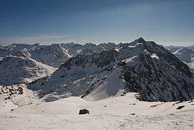
Piz Badus or Six Madun is a mountain in the Lepontine Alps, lying on the border between the cantons of Uri and Graubünden.
In its northwestern face, which is the Graubünden side, lies Tomasee, source of the Anterior Rhine. It is possible to reach the lake on a path from Oberalp Pass, suitable for most walkers although still a mountain trail.[2]
References
External links
This article is issued from Wikipedia - version of the 11/28/2016. The text is available under the Creative Commons Attribution/Share Alike but additional terms may apply for the media files.