Plémet
| Plémet Plezeved | ||
|---|---|---|
|
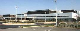
Medical Center of Central Brittany | ||
| ||
 Plémet | ||
|
Location within Brittany region  Plémet | ||
| Coordinates: 48°10′40″N 2°35′37″W / 48.1778°N 2.5936°WCoordinates: 48°10′40″N 2°35′37″W / 48.1778°N 2.5936°W | ||
| Country | France | |
| Region | Brittany | |
| Department | Côtes-d'Armor | |
| Arrondissement | Saint-Brieuc | |
| Canton | La Chèze | |
| Intercommunality | Loudéac | |
| Government | ||
| • Mayor (2014–2020) | Romain Boutron | |
| Area1 | 41.00 km2 (15.83 sq mi) | |
| Population (2008)2 | 2,929 | |
| • Density | 71/km2 (190/sq mi) | |
| Time zone | CET (UTC+1) | |
| • Summer (DST) | CEST (UTC+2) | |
| INSEE/Postal code | 22183 / 22210 | |
| Elevation | 82–241 m (269–791 ft) | |
|
1 French Land Register data, which excludes lakes, ponds, glaciers > 1 km² (0.386 sq mi or 247 acres) and river estuaries. 2 Population without double counting: residents of multiple communes (e.g., students and military personnel) only counted once. | ||
.svg.png)
Plémet (Breton: Plezeved, Gallo: Plémaèu) is a former commune in the Côtes-d'Armor department of Brittany in northwestern France. On 1 January 2016, it was merged into the new commune Les Moulins.[1]
Population
| Historical population | ||
|---|---|---|
| Year | Pop. | ±% |
| 1962 | 2,887 | — |
| 1968 | 2,928 | +1.4% |
| 1975 | 3,035 | +3.7% |
| 1982 | 3,056 | +0.7% |
| 1990 | 3,071 | +0.5% |
| 1999 | 2,936 | −4.4% |
| 2008 | 2,929 | −0.2% |
Inhabitants of Plémet are called plémétais in French.
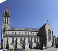
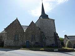
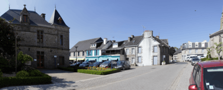
Gallery

_02.JPG)
See also
References
- ↑ Arrêté préfectoral 9 December 2015 (French)
External links
| Wikimedia Commons has media related to Plémet. |
This article is issued from Wikipedia - version of the 3/15/2016. The text is available under the Creative Commons Attribution/Share Alike but additional terms may apply for the media files.