Plandry
| Plandry | |||
|---|---|---|---|
| Municipality | |||
 | |||
| |||
 Plandry | |||
| Coordinates: 49°25′27″N 15°31′47″E / 49.42417°N 15.52972°ECoordinates: 49°25′27″N 15°31′47″E / 49.42417°N 15.52972°E | |||
| Country |
| ||
| Region | Vysočina | ||
| District | Jihlava | ||
| Area | |||
| • Total | 1.82 km2 (0.70 sq mi) | ||
| Elevation | 522 m (1,713 ft) | ||
| Population (1.1.2014) | |||
| • Total | 203 | ||
| • Density | 110/km2 (290/sq mi) | ||
| Postal code | 588 41 | ||
| Website | http://www.plandry.cz | ||


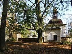
Plandry (Czech pronunciation: [ˈplandrɪ]) is a village and municipality (obec) in Jihlava District in the Vysočina Region of the Czech Republic.
The municipality covers an area of 1.82 square kilometres (0.70 sq mi), and has a population of 173 (as at 28 August 2006).
Plandry lies approximately 6 kilometres (4 mi) north-west of Jihlava and 109 km (68 mi) south-east of Prague.
References
| Wikimedia Commons has media related to Plandry. |
This article is issued from Wikipedia - version of the 4/7/2016. The text is available under the Creative Commons Attribution/Share Alike but additional terms may apply for the media files.