Plasmarl
Plasmarl, or Plas-Marl, is a suburban district and historically a village of the City and County of Swansea, Wales. It falls within the old copper quarter of Landore electoral ward.
Location
Plasmarl is centered on the A4067 road, which connects Swansea with the M4 motorway. The A4067, called Ffordd Cwm Tawe in the area, is a bypass to the older Neath Road (B4603), running parallel to it. The area to the west of Neath Road is mostly residential. The eastern side of Neath Road is lined with a number of major car dealerships. The area further east of the A4067, along Beaufort Road consists of an estate of light industry, warehousing and commercial units.
Buildings
Grade II listed buildings in Plasmarl include:[1]
- St. Paul's Parish Church on Cwm Level Road
- Dinas Noddfa Baptist Chapel on Dinas Street
- Ebenezer Baptist Church & Hall on Ebenezer Street
- Hermon Chapel & Sunday School on Neath Road
Sport in Plasmarl
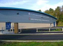
Plasmarl's local park, Cwm Level Park, hosts several football teams, most of which compete in the local Swansea leagues. The largest team which plays at the ground, Cwmfelin Press A.F.C., currently competes in the first division of the Swansea Senior League. Plasmarl is also home to Landore Bowls Stadium.
Plasmarl is close to Liberty Stadium, which is used by Swansea City A.F.C. and Ospreys.
Cwm Level Park
Cwm Level Park is a park based in Plasmarl. The park is the official ground for the Association Football Club Cwmfelin Press A.F.C. The park also has a playplace where young children can play. Several benches are also located around the park providing a view of the park and the on-looking road. The park is also less than half a mile in distance from the major sports ground, the Liberty Stadium.
Llewelyn Park
Llewelyn Park lies just north of Plasmarl. Llewelyn Park is located on land donated by John Dillwyn Llewelyn to the city along with money to develop then park in 1874.
Racing
The A4067 (parallel to Neath road) is frequently used as an illegal street racing strip. The cars and bikes meet at the nearby football field to organise events. Motorbike races are more common in the area and generally take place throughout the day whereas cars commonly race at night with reduced traffic. The spot is popular due to it being central in a stretch of three dual carriageways which allows for easy escape in the case of a police chase. A fatal crash took place in June 2008.[2]
Public Transport
| Southbound | ftrmetro | Northbound | ||
|---|---|---|---|---|
| Liberty Stadium | Plasmarl | Parc Terrace | ||
References
Coordinates: 51°39′01.00″N 3°55′54.00″W / 51.6502778°N 3.9316667°W