Point Basse
| Point Basse | |
|---|---|
| Historic Village | |
|
Original land survey map (1851). | |
 Point Basse Location within the state of Wisconsin | |
| Coordinates: 44°18′1″N 89°53′24″W / 44.30028°N 89.89000°WCoordinates: 44°18′1″N 89°53′24″W / 44.30028°N 89.89000°W |

Point Basse refers to both a sharp bend in the Wisconsin River near present day Nekoosa, Wisconsin, as well as to a nearby historic village downstream from the point itself, the village no longer being in existence. Other historic spellings included Pointe Basse, Point Bas, and Point Boss.[1][2] The Ojibwe name for the village on the west side of the river at the same location was Bangahjewung.[3] There is no currently existing geographic feature which retains the name. It was the location of the first rapids for travelers heading up stream, and the first place where these rapids were exploited for mill power.[4]
The village site was the location of a shallow river crossing that could be forded with a team of horses and a wagon at low water. In the winter, it was often safe to cross the ice. The crossing was near the end of modern day Wakely Road. Wakely was the name of a tavern owner at Point Basse in the 1830s and 1840s.[5] The geographic "point" that gave the town the name is the sharp bend about two miles upstream from the crossing, or a mile upstream from the modern Highway 73 bridge.[6]
The village became a crossroads of sorts, and for a brief span of years the primary terminus of the pineries road. In 1836 at the Cedar Point Treaty, the Menominee ceded to the US federal government a strip of land, three miles on each side of the river, beginning at Point Basse and extending to Big Bull Falls (modern Wausau, Wisconsin). Shortly after the cession was made, the mills on this strip of land grew to become the heart of the Wisconsin River lumber industry.[7]
Notes
- ↑ "Index". Wisconsin Historical Collections, Vol. XXI (1915). p. 407.
- ↑ For the spelling "Pointe Basse" see the plat image for T21N R5E Wood County, Wisconsin, available at http://www.glorecords.blm.gov/.
- ↑ Calkins, Hiram. "Indian nomenclature and the Chippewas". Wisconsin Historical Collections, Vol I (1854). p. 123.
- ↑ Ellis, A. G. "The 'Upper Wisconsin' Country". Wisconsin Historical Collections, Vol. III (1857). p. 438.
- ↑ Durbin, Richard D. (1997). The Wisconsin River: An Odyssey Through Time and Space. Cross Plains, WI: Spring Freshet Press. p. 103. ISBN 0-9658559-0-2.
- ↑ Ellis, p. 438. The mill is described here as "below Point Bas," referring from context to the river bend.
- ↑ Ellis, p. 438
Municipalities and communities of Wood County, Wisconsin, United States | ||
|---|---|---|
| Cities | 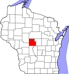 | |
| Villages | ||
| Towns | ||
| CDPs | ||
| Unincorporated communities | ||
| Indian reservation | ||
| Footnotes | ‡This populated place also has portions in an adjacent county or counties | |
Bibliography
- Ellis, A. G. "The 'Upper Wisconsin' Country". Wisconsin Historical Collections, Vol. III (1857). pp. 435–452.
- Durbin, Richard D. (1997). The Wisconsin River: An Odyssey Through Time and Space. Cross Plains, WI: Spring Freshet Press. ISBN 0-9658559-0-2.