Pomasqui Valley
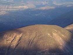

Pomasqui Valley is a valley on the northern outskirts of Quito, Ecuador. It is located on the equator, the so-called "Mitad del Mundo" ("Middle of the World"), at an altitude of around 2,600 metres (8,500 ft) above sea level. Hot and semi-arid, it is formed by a river tributary.[1] The valley contains the Cerro de Catequilla, which contains the pre-Columbian astronomical observatory, Catequilla. The village of Pomasqui itself lies roughly 6 kilometres (3.7 mi) from the equator.[2] The Monjas River flows nearby and the valley is an important centre for viniculture in Ecuador, with vineyards.[3] The economy features vegetable and fruit production.[4] To the northwest is the Pululahua Geobotanical Reserve.
History
The valley played an important role in military conflict as the Spanish army under Benalcazar invaded in 1534. Atahualpa leaders such as Rumiñahui and Quizquiz led organized attacks against the invading Spanish, and some 4000 locals were slaughtered by them here for giving in to the invaders.[5][6]
References
- ↑ Salomon, Frank (1978). Ethnic lords of Quito in the age of the Incas: the political economy of North-Andean chiefdoms. Cornell University. p. 236. Retrieved 20 July 2012.
- ↑ Rachowiecki, Rob (1992). Ecuador and the Galápagos Islands. Lonely Planet Publications. p. 137. ISBN 978-0-86442-148-7. Retrieved 16 July 2012.
- ↑ Perrottet, Tony; Eames, Andrew; Gil, Eduardo; Bell, Brian (1996). Ecuador, Galápagos. APA Publications. p. 342. ISBN 978-0-395-75500-6. Retrieved 16 July 2012.
- ↑ Newson, Linda A. (1995). Life and Death in Early Colonial Ecuador. University of Oklahoma Press. pp. 180–. ISBN 978-0-8061-2697-5. Retrieved 20 July 2012.
- ↑ Alchon, Suzanne Austin (18 July 2002). Native Society and Disease in Colonial Ecuador. Cambridge University Press. p. 33. ISBN 978-0-521-52945-7. Retrieved 16 July 2012.
- ↑ Rowe, Ann Pollard; Meisch, Lynn (1 June 2011). Costume and History in Highland Ecuador. University of Texas Press. p. 96. ISBN 978-0-292-72591-1. Retrieved 16 July 2012.
Further reading
- Almeida, R. E. (1995). Apuntes etnohistóricos del Valle de Pomasqui ("Ethnohistorical notes Pomasqui Valley"). Quito: Ediciones Abya-Yala.
Coordinates: 0°0′0″N 78°25′43.3″W / 0.00000°N 78.428694°W