Pommeuse
| Pommeuse | ||
|---|---|---|
| ||
 Pommeuse | ||
|
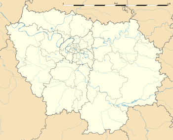
Location within Île-de-France region  Pommeuse | ||
| Coordinates: 48°49′02″N 3°01′02″E / 48.8172°N 3.0172°ECoordinates: 48°49′02″N 3°01′02″E / 48.8172°N 3.0172°E | ||
| Country | France | |
| Region | Île-de-France | |
| Department | Seine-et-Marne | |
| Arrondissement | Meaux | |
| Canton | Coulommiers | |
| Intercommunality | Brie des Moulins | |
| Government | ||
| • Mayor (2008–2014) | Jacques Alonso | |
| Area1 | 12.80 km2 (4.94 sq mi) | |
| Population (20012006)2 | 2,741 | |
| • Density | 210/km2 (550/sq mi) | |
| Time zone | CET (GMT +1) (UTC+1) | |
| • Summer (DST) | CEST (UTC+2) | |
| INSEE/Postal code | 77371 / 77515 | |
| Elevation | 55–146 m (180–479 ft) | |
|
1 French Land Register data, which excludes lakes, ponds, glaciers > 1 km² (0.386 sq mi or 247 acres) and river estuaries. 2 Population without double counting: residents of multiple communes (e.g., students and military personnel) only counted once. | ||
Pommeuse is a commune in the Seine-et-Marne department in the Île-de-France region in north-central France.
Demographics
Its inhabitants are called Pommeusiens.
Geography
Pommeuse is located in the valley of the Grand Morin and on the northern bank of the afore-mentioned valley. Two rivers flow through the commune: the Grand Morin and the Aubetin.
The largest part of the commune is occupied by agricultural land, dedicated to the growth of cereals (mainly corn and wheat), and the farming of cattle. Part of the commune is wooded, notably along the banks of the Grand Morin and on the bank of the valley. A railway line links Pommeuse to Paris in 56 minutes and also reaches out to the town of Coulommiers.
Neighboring communes
The neighboring communes are :
History
The word "Pommeuse" signifies bridge over the Morin. The commune was previously named Eboriac and was at the junction of two Roman highways.
The Pommeuse fief was created in 1144.
There were four successive castles or manors. The first dates back to the 11th century, and allowed the lord to perceive a taxe from the people wanting to cross the Morin. This castle was located on a mound overlooking the feodal land.
The second castle was surrounded by a mote fed by the Morin, and was severely damaged during the Hundred Years' War.
The third castle build around 1480 was based upon a Renaissance type model. It was destroyed during the revolution and its occupants (the De Langlois family) guillotined.
The fourth castle still inhabited to this day, was built from 1825 to 1830. It was upon recently still occupied by the De Langlois family.
Administration
| Election date | Identity | Title |
|---|---|---|
| Data for the period before 2001 is not yet known | ||
| March 2001 | Jacques Alonso | Mayor |
Demography
The population has doubled in 30 years, as it did in a large part of the east of the Paris area.
| 1975 | 1982 | c. 1990 | 1999 | 2001 | 2006 | |
|---|---|---|---|---|---|---|
| Total population | 1370 | 1518 | 1808 | 2476 | 2520 | 2741 |
| Starting in 1990: Population without duplicates | ||||||
Religious heritage
The commune is host to a twelfth-century church, and a more recent chapel. Pommeuse and the neighbouring village of Faremoutiers are united in one parish, itself part of the diocese of Meaux.
The abbot Jean Perrin (born 1912) has been the parish priest for 50 years. Mass has however only very rarely been celebrated in Pommeuse in the past few years because of the age of the priest.
Economy
A Pechiney factory used to exist by the Grand Morin, but was closed down, as a result Pommeuse is virtually devoid of industry. Economic activity is limited to:
- agricultural activity
- a chemists
- a bread shop
- a grocers
- a paper shop
- a hairdressers
- a play school and an elementary school
Places of interest
- Faremoutiers and Pommeuse train station.
- Pommeuse church
- four watermills
- monument for the commemoration of the dead of the World Wars
- the Pommeuse Castle.
See also
References
External links
| Wikimedia Commons has media related to Pommeuse. |
- www.pommeuse.org Official site. (French)
- Pommeuse Castle. (English)
- 1999 Land Use, from IAURIF (Institute for Urban Planning and Development of the Paris-Île-de-France région) (English)
- Map of Pommeuse on Michelin (English)
