Poortugaal
Coordinates: 51°52′N 4°24′E / 51.867°N 4.400°E

Portugaal, reformed church
View of Poortugaal.
Poortugaal is a village that is situated near the municipality of Rotterdam. Together with Rhoon, Poortugaal forms the municipality of Albrandswaard. The village has a long history dating back to the 15th century. It has a church dating from that period. The name is probably derived from Portugal.
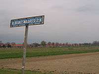
Since January 1, 1985, the village has been part of the municipality of Albrandswaard together with Rhoon.[1]
The village has a connection to the city of Rotterdam by Rotterdam Metro line D, through Poortugaal station.
References
- ↑ Ad van der Meer and Onno Boonstra (2006). "Repertorium van Nederlandse gemeenten". KNAW.
External links
- J. Kuyper, Gemeente Atlas van Nederland, 1865-1870, "Poortugaal". Map of the former municipality in 1868.
This article is issued from Wikipedia - version of the 2/2/2016. The text is available under the Creative Commons Attribution/Share Alike but additional terms may apply for the media files.