Puka Qallpa
| Puka Qallpa | |
|---|---|
 Puka Qallpa Location within Bolivia | |
| Highest point | |
| Elevation | 3,886 m (12,749 ft) [1] |
| Coordinates | 17°45′23″S 65°42′06″W / 17.75639°S 65.70167°WCoordinates: 17°45′23″S 65°42′06″W / 17.75639°S 65.70167°W |
| Geography | |
| Location |
Bolivia, Cochabamba Department |
| Parent range | Andes |
Puka Qallpa (Quechua puka red, qallpa terrain after the harvest,[2] also spelled Puca Khallpa) is a 3,886 m (12,749 ft) high mountain in the Bolivian Andes. It is located in the Cochabamba Department, Mizque Province, Alalay Municipality. It lies northwest of Kachi Q'asa and northeast of Inka Pirqa. The Puka Urqu Mayu ("red mountain river") flows along its western slope. Its waters flow to the Jatun Mayu ("big river") in the south.[1][3]
References
Capital: Cochabamba | ||
| Provinces | 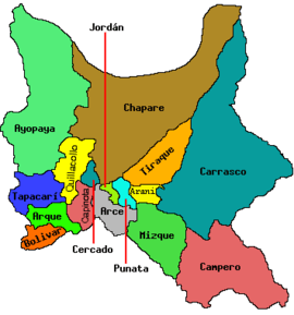 | |
| Municipalities (and seats) |
| |
This article is issued from Wikipedia - version of the 4/6/2016. The text is available under the Creative Commons Attribution/Share Alike but additional terms may apply for the media files.