Q'uwa Laki
| Q'uwa Laki | |
|---|---|
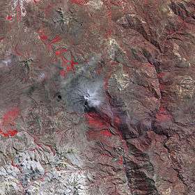
 The Ubinas volcano and Q'uwa Laki southwest of it (lower left) as seen from above (NASA, 2006) | |
| Highest point | |
| Elevation | 5,200 m (17,100 ft) [1] |
| Coordinates | 16°30′47″S 70°58′07″W / 16.51306°S 70.96861°WCoordinates: 16°30′47″S 70°58′07″W / 16.51306°S 70.96861°W |
| Geography | |
 Q'uwa Laki Peru | |
| Location | Peru, Moquegua Region |
| Parent range | Andes |
Q'uwa Laki (Aymara q'uwa a medical plant, laki distribution; a wise person specialized in healing diseases,[2][3][4] hispanicized spelling Coalaque) is a mountain in the Andes of Peru, about 5,200 metres (17,060 ft) high . It is located in the Moquegua Region, General Sánchez Cerro Province, on the border of the districts Coalaque, Matalaque and Omate. Q'uwa Laki lies southeast of the peaks of Qillqata and Wilani.[1]
References
- 1 2 escale.minedu.gob.pe - UGEL map of the General Sánchez Cerro Province (Arequipa Region)
- ↑ Teodoro Marka M., Curso Basico de Lengua Aymara, Nociones Basicas de Lengua Aymara
- ↑ "Diccionario Bilingüe, Castellano - Aymara, 2002". Félix Layme Pairumani. Retrieved November 18, 2014. (see: Reparto)
- ↑ Jorge Hidalgo L. et al., Culturas de Chile, Etnografía, Sociedades Indígenas Contemporáneas y su Ideología, Editorial Andrés Bello
This article is issued from Wikipedia - version of the 3/6/2016. The text is available under the Creative Commons Attribution/Share Alike but additional terms may apply for the media files.