Quebra Canela
| Quebra Canela | |
|---|---|
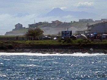 Quebra Canela beach in front, Palmarejo Neighborhood behind, Fogo Island farther in the back in 2008, CinePraia and a street have now been added today | |
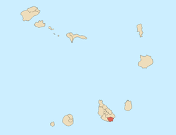
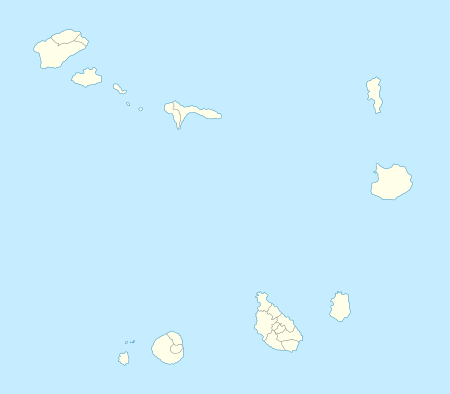 Quebra Canela Location within Cape Verde | |
| Location | South of Praia in Santiago, Cape Verde |
| Coordinates | 14°54′15″N 23°31′02″W / 14.9041°N 23.5171°W |
| Access | road |
| Beach length | 200 m |
Quebra Canela (Capeverdean Creole: Kebra Kanela) is a tiny beach and a subdivision in the south of Praia in the island of Santiago, Cape Verde and is the second southernmost neighborhood, it is also the smallest and the leastly populated neighrborhood of Praia. The beach is crescent shaped and is 200 meters long and 30 meters wide.
About Quebra Canela
The area is narrow, its length is around 600 meters and ranging from 200 to 250 meters wide, The highest point is about 30 meters, the lowest point is the Atlantic and the Bay of Porto Praia.
The neighborhood is named after a tiny beach which is 100 meters length and 10 meters wide. Surrounded by small rocky cliffs and recently hotels and villas. Another tiny beach to the west is Quebra Branca which also belongs to Prainha, the westernmost port is where a hotel is located.
Bordering neighborhoods includes Palmarejo to the west, Achada de Santo António to the north and Prainha to the northeast.
Hotel VIP Praia is in the westernmost portion.
The main streets are Avenida Jorge Barbosa running to the south, named after a famous writer and a street that connects with Largo Europa in Achada de Santo António.
History
Before the urban sprawl reached the southernmost point of the island in the 1990s, the area was predominantly barren and rarely forested.
Agriculture dominated the northern part to the 1990s when the urban sprawl of Praia spread to the area. Buildings popped up in the 1990s. Restaurants started to appear in the 2000s, Alkmiste and Aqva restaurants.
In 2012, a new cinema opened in the southwestern portion and named Cine Praia (or spelt as CinePraia) and nearby in 2015, three new restaurants opened. Praia Shopping also opened. Another restaurant known as Kebra Kabana opened at the rotary.
Landmarks and points of interest
- Praia Shopping
- Cine Praia
Panoramics
Panoramics includes the Atlantic along with the southernmost areas of Palmarejo and Cidadela, at the southernmost portion, the area of Monte Vermelho can be seen. The island of Fogo, the eastern part can be seen. It is the place where not too many features can be seen.
Transportation
Two transit line passes in the westernmost portion, they include:[1]
- Palmarejo - Plateau – Achada Grande
- Palmarejo – Plateau – Eugénio Lima
References
| Neighbourhoods |
|   |
|---|---|---|
| Geographical features | ||
| Major squares |
| |
| Major streets and arterials |
| |
| Universities and educational institutions |
| |
| Landmarks and tourism | ||
| Sports facilities and complexes | ||
| Transportation | ||
| Culture |
| |
| History (Timeline) | ||
Coordinates: 14°54′15″N 23°31′02″W / 14.9041°N 23.5171°W