Imperial River (Chile)
| Imperial River | |
|---|---|
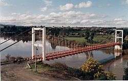
 Carahue Suspension Bridge | |
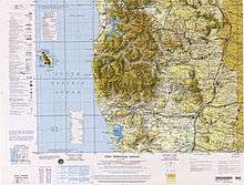
 Map of the Region of Temuco | |
| Country | Chile |
| Basin | |
| River mouth | Pacific Ocean |
| Basin size | 12.763 km2 (4.928 sq mi)[1] |
| Physical characteristics | |
| Length | 55 km (34 mi)[1] |
Imperial River is a river located in the La Araucanía Region of Chile. It is formed at the confluence of the Chol Chol and Cautín Rivers in the vicinity of the city of Nueva Imperial.
The towns of Carahue and Puerto Saavedra sit along the banks of the Imperial river. Near its mouth is located the outlet of Budi Lake.
The river borders the Cordillera de Nahuelbuta.
References
External links
Coordinates: 38°47′S 73°24′W / 38.783°S 73.400°W
This article is issued from Wikipedia - version of the 5/28/2016. The text is available under the Creative Commons Attribution/Share Alike but additional terms may apply for the media files.
