Rafha Domestic Airport
| Rafha Domestic Airport مطار رفحاء المحلي | |||||||||||
|---|---|---|---|---|---|---|---|---|---|---|---|
| IATA: RAH – ICAO: OERF | |||||||||||
| Summary | |||||||||||
| Airport type | Public | ||||||||||
| Operator | Government | ||||||||||
| Serves | Rafha | ||||||||||
| Location | Northern Borders Province, Saudi Arabia | ||||||||||
| Elevation AMSL | 1,474 ft / 449 m | ||||||||||
| Coordinates | 29°37′34.8″N 043°29′26.5″E / 29.626333°N 43.490694°ECoordinates: 29°37′34.8″N 043°29′26.5″E / 29.626333°N 43.490694°E | ||||||||||
| Map | |||||||||||
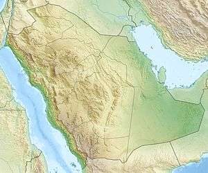 OERF Location of airport in Saudi Arabia | |||||||||||
| Runways | |||||||||||
| |||||||||||
|
Sources: [1] | |||||||||||
Rafha Domestic Airport (Arabic: مطار رفحاء المحلي, IATA: RAH[2], ICAO: OERF) is an airport serving Rafha, a town in Northern Borders Province, Saudi Arabia. It is located almost halfway between Hafr al-Batin (about 275 kilometres (171 mi) to the southeast) and Arar (about 280 kilometres (174 mi) to the northwest).
Facilities
The airport resides at an elevation of 1,474 feet (449 m) above mean sea level. It has one runway designated 11/29 with an asphalt surface measuring 3,000 by 45 metres (9,843 ft × 148 ft).
Airlines and destinations
Airlines offering scheduled passenger service:
| Airlines | Destinations |
|---|---|
| Saudia | Jeddah, Riyadh |
References
- ↑ Airport information for RAH at Great Circle Mapper. Source: DAFIF (effective October 2006).
- ↑ "IATA Airport Code Search (RAH: Rafha)". International Air Transport Association. Retrieved 8 September 2013.
External links
- Aeronautical chart for OERF at SkyVector
- Current weather for OERF at NOAA/NWS
- Accident history for RAH at Aviation Safety Network
This article is issued from Wikipedia - version of the 12/4/2016. The text is available under the Creative Commons Attribution/Share Alike but additional terms may apply for the media files.