Red River Gorge Climbers' Coalition
|
| |
| Local Climbing Orgization | |
| Founded | 1996 |
| Headquarters | Eastern Kentucky, United States |
Area served | Red River Gorge Region |
| Members | 500+ |
| Website | rrgcc.org |
The Red River Gorge Climbers' Coalition (RRGCC) is an advocacy group for rock climbers in the Red River Gorge, Kentucky. Through relationships with local stakeholders and climbers from all over the world, the RRGCC has worked hard to maintain sustainable access throughout one of the world's top climbing destinations.
History
The Red River Gorge Climbers' Coalition was founded by local climbers Shannon Stuart-Smith and Kris Snyder in November 1996 as a local climber's advocacy group to protect climbing at the Red River Gorge. Rock climbing in the Red River Gorge area had originally occurred primarily on the public lands of Daniel Boone National Forest and was therefore subject to the jurisdiction of the U.S. Forest Service. In 1996 the Forest Service issued for the first time ever a Rock Climbing Management Guide for the Red River area. This guide, or RCMG, was viewed negatively by climbers. As a direct result of the issuance of the RCMG, Shannon and Kris decided to form a climbers' coalition to champion climbers' interests and to try to improve relations between the Forest Service and climbers. Their main concern was twofold, re-writing the RCMG to include climbers' input and thereby "improving" it and educating and empowering climbers to ensure the long-term future of climbing.
Today the RRGCC has grown to a several hundred member-strong, all volunteer, advocacy group that continues to work with the US Forest Service on ensuring access to climbing in the Daniel Boone National Forest. The Coalition has also expanded its efforts to include working with the Natural Bridge State Park, and many local private land owners as well. The RRGCC's main focus has been from its inception, protection and promotion of responsible climbing. This goal has taken many forms, from building environmentally friendly climber trails to popular crags, to articles in its quarterly newsletter on top-rope safety. Climbing continues to grow in popularity and change, and so do the issues surrounding it. For people to continue to enjoy the freedom to climb on public and private land, innovative and creative solutions will have to be sought. On February 7, 2000 the Red River Gorge Climbers' Coalition and the U.S. Forest Service signed a Memorandum of Understanding.[1] The signing of this MOU represents a significant breakthrough for Red River Gorge climbers and the Forest Service after years of skepticism, mistrust, and alienation.
The Board of Directors
As of 2013[2]
- Paul Vidal - President
- Bentley Brackett - Vice President
- Uma Nanjundan - Treasurer
- Josephine Neff - Secretary
- David King - BOD Member
- Rick Bost - BOD Member
- Yasmeen Fowler - BOD Member
- Mike Driskell - BOD Member
- Katy Gulley - BOD Member
- Staff
- Matt Tackett - Land Manager
- Bill Strachan - Executive Director
Pendergrass-Murray Recreational Preserve (PMRP)

The Pendergrass-Murray Recreational Preserve, or the PMRP, is 750 acres (3.0 km2) of land now owned and maintained by the RRGCC. This land, now open to the public, is a commitment to preserving and sustaining climbing access in the Red River Gorge indefinitely.
In the 1990s, as climbing grew in popularity as a sport, the RRGCC Coalition formed with the intent of permanently securing access to climbing in the Red River Gorge region. However, being on the East Coast, most of the climbing opportunities were available only on private property or Forest Service land. In 1996, the USFS enacted a bolting ban on its land, effectively ending the development of sport climbing in those areas.[3] While working with the Forest Service to improve relations and explore the options, the Coalition was also working with private landowners to secure access to climbing and development. With the rising popularity of climbing, though, to be a touchy situation since relations grew increasingly tense with landowners and their wishes to maintain their privacy and independence.
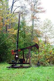
In the late 1990s and early 2000s, the potential for development, particularly sport climbing, was discovered in the Southern Region, where steep, beautiful sandstone walls are overhanging and pocketed and offer technical, dynamic, and endurance climbing. As word spread and climbers flocked to the Bald Rock Fork and Coal Bank Hollow areas, conflicts arose between climbers and oil companies in the region, especially related to limited parking causing road blocks. The first well known and developed areas The Motherlode lies on private land just outside PMRP. With over 50 routes in 5.11-5.14 range, it is one of the most well known destination for hard climbing in the region. Other climbing areas in PMRP hostes more than 500 climbs, ranging from 5.4 to 5.14c, with new climbs constantly being discovered and developed. The property hosts several hundred climbers each weekend, with the three parking lots often reaching capacity by noon.
In 2004, when more than 750 acres (3.0 km2) of land in the Southern Region came available, the RRGCC, recognizing the opportunity to secure access in the area, moved quickly to purchase the land. Negotiating with the Murray family, the Coalition and the Murray's reached an agreement and the ownership of the land was transferred to the RRGCC. To finance the purchase, the RRGCC worked out an owner-financed mortgage of 8% a year for 10 years. With a few maintenance costs, the final yearly costs translate to nearly $30,000 per year. The last mortgage payment was made in 2012, and the RRGCC fully owns the PMRP.[4] The payments are financed from private donations and from support of The Access Fund [5] a national climbing advocacy organization.
Climbing areas in and around Pendergrass-Murray Recreational Preserve (PMRP)
- Bob Marley Crag
- Bronaugh Wall
- Chica Bonita Wall
- Courtesy Wall
- The Crossroads
- Curbside
- The Dark Side
- Drive-By Crag
- The Far Side
- The Gallery
- Left Field
- The Motherlode
- North 40
- The Playground
- Purgatory
- Rival Wall
- Shady Grove
- Shire, The
- Solar Collector and Gold Coast
- Volunteer Wall
- What About Bob Wall
Miller Fork Recreational Preserve (MFRP)
Sitting just east of the PMRP, across highway 11, is the Miller Fork Recreational Preserve, 309 acres (1.25 km2) of land now owned by the RRGCC. In May 2012 the RRGCC, with the help of The Access Fund, closed a deal on acquiring this land. The RRGCC is expected to own the land fully by the end of 2017.[6]
Ray Ellington's newest book, Miller Fork Climbing, released in October 2015, explores the hundreds of new routes along the walls of the MFRP.[7]
Climbing areas in and around Miller Fork Recreational Preserve (MFRP)
- Alcatraz
- Chaos
- Cloud 9
- Cooper's Cove
- Corner Pocket
- Deep End
- Fruit Wall
- Graveyard
- Hal Garner Memorial Crag, The
- Highlands
- Infirmary, The
- Laboratory, The
- Monastery
- Morgue, The
- Nursery, The
- Pharmacy, The
- Portal, The
- Real Deep End
- Record Shop, The
- Scotch Wall
- Secret Garden
- Serenity Point
- Vine Wall
Events organized by RRGCC
2008 Events
- April 18: Red River Reunion (all weekend)
- August 2: Johnny and Alex Trail Day (all day)
- September 12: Mountain Gear's UClimb (all day) not an RRGCC event, though some proceeds go to help the RRGCC
- September 26: Muir Valley Trail Day (all day) not an RRGCC event - visit Muir Valley for more information
- October 9–11: 8th Annual Rocktoberfest in the RRG (all weekend)
2009 Events
- April 18–19: Red River Reunion (all weekend)
- August 1: Johnny and Alex Trail Day (all day)
- September 12–13: Mountain Gear's UClimb (all day) not an RRGCC event, though it is supported by the RRGCC and some proceeds go to help the RRGCC
- September 26: Muir Valley Trail Day (all day) not an RRGCC event - visit Muir Valley for more information
- October 9–11: 9th Annual Rocktoberfest in the RRG (all weekend)
Notes and references
- ↑ RRGCC & DBNF Memorandum of Understanding, Retrieved on July 13, 2008
- ↑ Meet the BOD, Retrieved on February 24, 2013
- ↑ DBNF - Rockclimbing, USFS, November 7, 2007 Retrieved on July 13, 2008
- ↑ Red River Climbers' Coalition - The PMRP, Retrieved on July 13, 2008
- ↑ "Access Fund News from June 7, 2010". Retrieved 6 July 2010.
- ↑ "The MFRP » Red River Gorge Climbers' Coalition". rrgcc.org. Retrieved 2016-05-07.
- ↑ "Miller Fork Climbing". www.redriverclimbing.com. Retrieved 2016-05-07.