Red Roses
| Red Roses | |
| Welsh: Rhos-goch | |
 View from the south-west |
|
 Red Roses |
|
| OS grid reference | SN203117 |
|---|---|
| Community | Eglwyscummin |
| Principal area | Carmarthenshire |
| Ceremonial county | Dyfed |
| Country | Wales |
| Sovereign state | United Kingdom |
| Post town | Whitland |
| Postcode district | SA34 |
| Dialling code | 01834 |
| Police | Dyfed-Powys |
| Fire | Mid and West Wales |
| Ambulance | Welsh |
| EU Parliament | Wales |
| UK Parliament | Carmarthen West and South Pembrokeshire |
| Welsh Assembly | Carmarthen West and South Pembrokeshire |
|
|
Coordinates: 51°46′59″N 4°36′00″W / 51.783°N 4.6°W
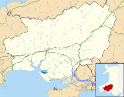
Red Roses (Welsh: Rhos-goch, "red moor") is a village in southwestern Carmarthenshire, Wales. It is in a rural location and its economy is mainly dependent on farming and tourism. Although previously the A477 ran through what is perceived to be the centre of the village, a bypass was built to the North and through the West of the village between 2012 and 2014.
Geography
Situated in south-west Carmarthenshire, near the border with Pembrokeshire, the village forms part of the Eglwyscummin Community area with Ciffig and Marros which in turn forms part of the Laugharne Township ward. The village is located around the main route to south Pembrokeshire, the A477, and the B4314 which is one of the main routes to the holiday resort of Pendine.[1]
Roads
The village is centred on the crossing of the original but now de-listed A477 and B4314 roads. The crossroads was once a major accident black spot [2] but numbers were reduced when a 40 mph speed limit and an anti skid road surface were added. The building of a by-pass diverting the A477 to the North and through the West of the Village by use of an underpass, previously earmarked over many years, started in 2012 [3] and was opened on 16 April 2014.[4][5]
Local amenities
Surrounded by farming land, the village is near to a number of holiday destinations and has a holiday park for static caravans and another one for touring caravans.[6] The economy is largely dependent on farming and tourism.[7] A community centre, built in 2008, now occupies the site where an old Methodist Chapel lay abandoned for some time.[7] The local public house - the Sporting Chance, which at one time was named Llwyngwair Arms, has been closed since March 2014.[8]
References
| Wikimedia Commons has media related to Red Roses, Wales. |
- ↑ Landranger 158: Tenby (Map). 1:50 000. Ordnance Survey.
- ↑ "Bypass that is planned for accident blackspot is delayed until 2014". Cardiff: Wales Online. 3 December 2010. Retrieved 1 September 2016.
- ↑ "A477 St Clears to Red Roses improvement route announced". Cardiff: Welsh Assembly Government. 31 October 2006. Retrieved 19 July 2009.
- ↑ "Section of A477 officially opens after £68m upgrade". ITV News Wales. 16 April 2014. Retrieved 17 April 2014.
- ↑ "£68million improvements to A477 brings benefits to the economy, tourism and local communities". Welsh Government News. 16 April 2014. Retrieved 17 April 2014.
- ↑ "The Old Vicarage Holiday Park". Vale Holiday Parks. Retrieved 27 April 2016.
- 1 2 "Red Roses Community Centre, Red Roses". Carmarthenshire Community Halls. Retrieved 27 April 2016.
- ↑ "Sporting Chance". What Pub. Campaign for Real Ale. Retrieved 27 April 2016.