Ottawa Regional Road 174

Ottawa Road 174, formerly referred to as Ottawa-Carleton Regional Road 174 and commonly referred to as Highway 174, is a city maintained road in the City of Ottawa which serves the eastern suburbs of Orléans and Cumberland. Although the road continues through the towns of Rockland and Hawkesbury to the Quebec border, the portion east of the Ottawa city boundary is known as Prescott and Russell County Road 17. Originally the alignment of Highway 17 between Ottawa and the Quebec border, Regional Road 174 (as it was known then) was created on April 1, 1997 when the provincial government of Mike Harris transferred responsibility for portions of the road to the Regional Municipality of Ottawa–Carleton. The road was extended by a second transfer on January 1, 1998, bringing it to its current length.
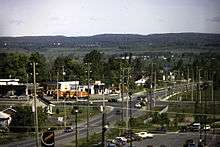
Route description
The segment between the Highway 417 junction to Trim Road is a four-lane freeway with OC Transpo lanes in each direction from just east of Blair Road to Place d'Orleans. East of Trim Road, it becomes a two-lane rural highway until the Prescott-Russell county line where it becomes Prescott-Russell County Road 17 until the eastern end at Highway 417 east of Hawkesbury. Over the past few years, traffic between Highway 417 and Rockland became much heavier due to suburban growth in Orléans and Rockland leading to frequent congestion during peak hours. Meanwhile, the easternmost portion of the road was regarded as dangerous due to several fatal accidents. In 2007, both the provincial and federal governments committed funding for the widening of Ottawa Road 174 between Trim Road and Rockland, although the widening project was still several years away. However, in April 2008, Ottawa City Council refused a $80 million funding from both provincial and federal governments citing it would not benefit Ottawa, which delayed the construction indefinitely.[1]
History
Regional Road 174 was created on April 1, 1997 when the Ministry of Transportation of Ontario transferred the responsibility of maintenance and upkeep along 14.2 km (8.8 mi) of Highway 17 east of "the split" with Ontario Highway 417 to Trim Road (Regional Road 57), a process commonly referred to as downloading. Despite the protests of the city that the road served a provincial purpose, a second round of transfers saw Highway 17 east of Ottawa downloaded entirely on January 1, 1998 adding 12.8 km (8.0 mi) to the length of Regional Road 174. Ottawa immediately renumbered the transferred sections of Highway 17.[2] When the Regional Municipality of Ottawa–Carleton amalgamated with the municipalities of the region to form the new City of Ottawa in 2001,[3] Regional Road 174 was renamed Ottawa Road 174 to reflect its new status as a city-owned road.
Incidents
A sinkhole occurred on Regional Road 174 at the Jeanne D'Arc interchange on September 4, 2012 at around 17:00, closing the eastbound lanes. Traffic was rerouted via the Montreal Road interchange and St. Joseph Boulevard for traffic to Orleans, Cumberland, and Clarence-Rockland.[4]
On September 17, 2012, both eastbound lanes were re-opened to traffic.
Future Transfer to the Province
The section of roadway costs the City of Ottawa millions to maintain, which has resulted in a backlog of repairs. Several sinkholes and potholes have remained unfixed for months. The road was built by the province the 1950s, then transferred to the cash strapped county in the late 1990s. The highway was called for expansion several times, but the unavailability of funds has resulted in increased congestion in the region.
The city aims to negotiate a settlement to maintain the roadway with the province in the future. Several municipal politicians have petitioned the province to turn the highway back into provincial jurisdiction.
Major intersections
The following table lists the major junctions along Ottawa Regional Road 174.[5] The entire route is located in Ottawa.
| km[5] | mi | Destinations | Notes | ||
|---|---|---|---|---|---|
| 0.0 | 0.0 | The Split | |||
| 1.1 | 0.68 | Blair Road | |||
| 3.7 | 2.3 | Montreal Road | |||
| 7.9 | 4.9 | Jeanne D'arc Boulevard | |||
| 9.9 | 6.2 | Regional Road 39 (Champlain Street) | Access to Place d'Orleans mall | ||
| 13.2 | 8.2 | Regional Road 57 (Trim Road) | |||
| End of divided freeway | |||||
| 20.0 | 12.4 | Regional Road 35 (Cameron Street) | |||
| 22.2 | 13.8 | Morin Road | |||
| 24.9 | 15.5 | Old Montreal Road | Original route of Highway 17 | ||
| 26.1 | 16.2 | Canaan Road | Ottawa city limits; route continues east as County Road 17 | ||
| 1.000 mi = 1.609 km; 1.000 km = 0.621 mi | |||||
See also
References
- ↑ http://www.ottawa.ca/calendar/ottawa/citycouncil/trc/2008/04-16/ACS2008-PTE-PLA-0105.htm
- ↑ Department of Public Works and Services (September 14, 2004). Responsibilities and Obligations Re: Highway 174 (Report). City of Ottawa. Retrieved February 14, 2011.
- ↑ "City of Ottawa Act, 1999, Chapter 14, Schedule E". Service Ontario/Legislative Assembly of Ontario. Retrieved 2012-09-10.
- ↑ "Archived copy". Archived from the original on September 12, 2012. Retrieved September 11, 2012.
- 1 2 Ministry of Transportation of Ontario (April 1, 1989). Provincial Highways Distance Table. Government of Ontario. p. 37. ISSN 0825-5350.