Renfrew
| Renfrew | |
| Scottish Gaelic: Rinn Friù | |
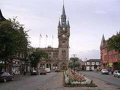
 Renfrew Town Hall and centre |
|
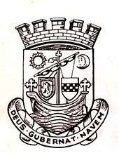
 Arms of Renfrew Community Council |
|
 Renfrew |
|
| Population | 21,854 (2011 census) |
|---|---|
| OS grid reference | NS519186 |
| Council area | Renfrewshire |
| Lieutenancy area | Renfrewshire |
| Country | Scotland |
| Sovereign state | United Kingdom |
| Post town | Renfrew |
| Postcode district | PA4 |
| Dialling code | 0141 |
| Police | Scottish |
| Fire | Scottish |
| Ambulance | Scottish |
| EU Parliament | Scotland |
| UK Parliament | Paisley and Renfrewshire North |
| Scottish Parliament | Renfrewshire North and West |
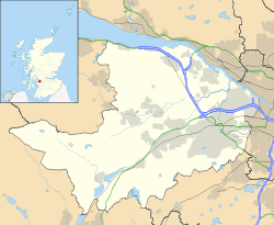
Coordinates: 55°52′01″N 4°22′01″W / 55.867°N 4.367°W
Renfrew (/ˈrɛnfruː/; Scottish Gaelic: Rinn Friù) is a town 6 miles (10 km) west of Glasgow, and the historical county town of Renfrewshire. Called the "Cradle of the Royal Stewarts" for its early link with Scotland's former royal house, Renfrew gained royal burgh status in 1397. The town is also a barony: the current Baron of Renfrew is Prince Charles, Duke of Rothesay (aka the Prince of Wales) who holds lands in the area.
As the county town, Renfrew once was a centre of local government for the surrounding area. Whilst the county remained known as "Renfrewshire", the focus of local government gradually shifted from Renfrew to its larger neighbour Paisley. Following the reorganisation of 1996, Renfrewshire was divided for local government purposes into three modern council areas: Renfrewshire, with considerably smaller boundaries than the old county, including Renfrew and with its administrative centre at Paisley; Inverclyde with its centre at Greenock, covering the western part of the county; and East Renfrewshire, with its centre at Giffnock. The boundaries of the historic County of Renfrew remain for a number of ceremonial and administrative purposes.
History
The name Renfrew comes from the Old British rhyn frwd meaning "point at the current"; the River Cart enters the Clyde by the town.[1] Renfrew's recorded history began with the granting of land in the area to Walter fitz Alan, the High Steward of Scotland by King David I in the 12th century. The strategic location of this castle was to prevent the eastern expansion of the lordship belonging to Somerled, the Lord of the Isles, and to protect western Scotland from Norse invaders.[2] Eventually the hereditary title of High Steward came to form the surname Stewart.
The castle was situated in what is now part of the well-known Braehead shopping complex. It was located on the King's inch or King's island. This location both added to the castle's defences but also added to its strategic positioning on the Clyde. Many street names close to this area demonstrate the survival of knowledge of this citadel. 'Orchard Street' is a reference to the royal orchards for example.
Later in the 12th century, King Malcolm IV, grandson of David, finally demanded Somerled's fealty. In 1164, Somerled sailed to Renfrew and attacked an assembling Scottish army in a conflict known as the Battle of Renfrew. The outcome was a defeat of the Lordship of the Isles and the death of Somerled.[3] The Lords of the Isles were eventually stripped of their lands and titles in 1493, as a consequence of conspiring with an earlier King of England (Edward IV) to overthrow the Scottish monarchy. Since that time, "Lord of the Isles" - as with "Baron of Renfrew" - has been a courtesy title of the heir to the throne and both are currently held by The Prince Charles, heir to Queen Elizabeth II.
The role of the Stewarts continued to grow and in 1315 Walter Stewart, 6th High Steward married Marjorie, daughter of King Robert the Bruce. Their son succeeded to the throne as Robert II of Scotland.
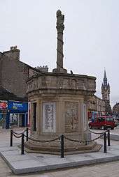
During the Monmouth Rebellion of 1685, Archibald Campbell, 9th Earl of Argyll was injured and captured at Renfrew before being transported to Edinburgh and executed for his role in attempting to overthrow the Crown. The Argyle Stones in the town mark the site where his capture took place.[4]
During the night of 13 March 1941, three Polish airmen saved Renfrew's Roman Catholic church of Saint James. Lance Corporal Pawel Radke, Aircraftman Antoni Ptaszkowski and Aircraftman Zygmunt Sokolowski were at the church and at great risk were extinguishing incendiaries. These had caused a number of fires in the church. Two of the airmen were killed by a bomb and the third died in Alexandria Hospital the following day. They were in their twenties. When 309 Squadron transferred to Dunino in Fife in May 1941, it presented to the church a portrait of Our Lady as a token of their appreciation to the people of Renfrew. Parishioners never forgot the sacrifice and in October 1982 at a special Mass, a silver plaque in memory of the airmen and the portrait of the Black Madonna was blessed and dedicated by Bishop McGill. The plaque was crafted by a local Polish jeweller, Eugeniusz Waclawski.[5]
At the General Assembly of the Church of Scotland in 2013, the Rev Lorna Hood, minister at Renfrew North Parish Church and a Chaplain to The Queen, became Moderator of the Assembly for the subsequent annual term.[6]
Renfrew also has two Masonic Lodges; Prince of Wales and Lodge Moorpark, numbers 426 and 1263 respectively, of the Roll of the Grand Lodge of Scotland.
Governance

Local government and royal burgh

Although the town gives its name to the council area of Renfrewshire and the larger county of the same name which was used for local government before 1975, the administrative functions of both have in modern times been operated from the considerably larger neighbouring town of Paisley.
The early origins of Renfrewshire lie in the expanding influence of the Stewarts of Renfrew, the family holding the hereditary High Stewardship of Scotland. In 1371, Robert Stewart was crowned King of Scotland as Robert II and in 1402 his son, Robert III established the shire of Renfrew crafted from territory previously within the shire of Lanark and based out of Renfrew, the site of the Stewarts' castle.
Renfrewshire's Commissioners of Supply, Quarter Sessions and freeholders met at Renfrew, as did the sheriff court until it was moved to Paisley in 1705. This began a gradual move in the focus of local government to Paisley. During this time, Renfrew continued to hold status not only as a royal burgh, but as a parliamentary, municipal and police burgh.[7]
Renfrew is now represented by its own community council, which meets in Renfrew Town Hall.[8]
Parliament of the United Kingdom
Renfrew was a parliamentary burgh as a component of Glasgow Burghs from 1708 to 1832, and as a component of Kilmarnock Burghs from 1832 to 1918, when it was merged into the East Renfrewshire constituency.
Since 2005, it has been part of the Paisley and Renfrewshire North constituency.
Gavin Newlands, SNP MP currently holds the seat for the constituency (2015-)
Transport
The M8 motorway intersects Renfrew and two junctions at Arkleston and Braehead provide access to the town, with the neighbouring town of Paisley largely lying on the opposite side. The former Renfrew Airport was located to the south of the town (only a couple of miles from the present Glasgow Airport). The site of the terminal building is now occupied by a Tesco supermarket.[9] The Renfrew Ferry connects to Yoker on the north bank of the Clyde, with the crossing taking a few minutes to make. Renfrew was also once served by a series of stations on a branch of the Glasgow and Paisley Joint Railway. However it was closed to passengers in 1967.
Renfrew is served by the McGills bus company which operates regular services to the Braehead Shopping Centre, and has various routes that pass through Renfrew connecting Erskine, Glasgow city centre, Paisley, and Govan. A service operated by First Glasgow buses also passes through part of the town on its way between Glasgow airport and the city.
Economy
The major industry of Renfrew was previously shipbuilding. Simons and Lobnitz, most notable for building sand dredgers were based in the town. The Renfrew shipyard closed in the early 1960s.[10]
Further expansion of Renfrew's economy took place in 1938 with the opening of Hillington industrial estate, now named Hillington Park, not to be confused with Hillington housing estate in the city of Glasgow.
Renfrew is home to the engineering company Doosan Babcock (formerly Babcock & Wilcox), the King George V Dock and the Braehead out-of-town retail development.
Geography
 |
Clydebank |  | ||
| Inchinnan | |
Govan | ||
| ||||
| | ||||
| Paisley |
Renfrew is at the confluence of the River Clyde and the River Cart. A passenger ferry crosses the Clyde to Yoker and a bascule bridge spans the Cart to Inchinnan and Glasgow International Airport.
See also
- Doosan Babcock
- Robertson Park
- Braehead
- Normandy Hotel
- Renfrew Ferry
- White Cart Bridge
- Renfrew Golf Club
Notes
- ↑ Hanks, Patrick; Hodges, Flavia; Mills, A. D.; Room, Adrian (2002). The Oxford Names Companion. Oxford: the University Press. p. 1168. ISBN 0198605617.
- ↑ "Renfrew History". Retrieved 21 January 2010.
- ↑ Paterson 2008, p9
- ↑ HUGH CRAIG. "The Argyll Stones (C) HUGH CRAIG :: Geograph Britain and Ireland". geograph.org.uk.
- ↑ "Portrait of a Lady and a Silver Plaque in memory of Polish Airmen". www.ostrycharz.free-online.co.uk. Retrieved 19 June 2012.
- ↑ http://www.churchofscotland.org.uk/news_and_events/news/articles/queens_chaplain_to_be_next_moderator
- ↑ http://www.1911encyclopedia.org/Renfrew
- ↑ Renfrewshire Community Website - Renfrew meetings
- ↑ http://www.myrenfrew.com/Airport.htm
- ↑ http://www.archives.gla.ac.uk/collects/catalog/ugd/201-250/ugd215.html
References
- Patterson, Raymond Campbell (2008). The Lords of the Isles, A history of Clan Donald. Edinburgh: Birlinn Limited. ISBN 1-84158-718-4.
Further reading
- History of Renfrew, J.A. Dunn, Town Council of Renfrew, 1971
External links
| Wikimedia Commons has media related to Renfrew. |