Rhymney River
The Rhymney River (Welsh: Afon Rhymni) is a river in the Rhymney Valley, south-east Wales, flowing through Cardiff into the Severn estuary. The river formed the boundary between the historic counties of Glamorgan and Monmouthshire.
Path of the river
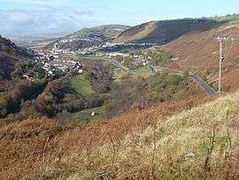
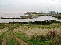
The river runs south from its source through (in order) Rhymney, New Tredegar, Bargoed, Ystrad Mynach, Llanbradach (then to the north of Caerphilly), Bedwas, Trethomas, Machen, Draethen, Llanrumney and Rumney (two districts of Cardiff), before joining the Bristol Channel.
History
The Rhymney Valley (Welsh: Cwm Rhymni) was created as a glacial valley. Sourced within the valley, on the southern edge of the Brecon Beacons, the Rhymney River descends steeply through the town of New Tredegar towards Ystrad Mynach, and then onwards south across a flat plain before entering the Severn Estuary to the east of Cardiff. The villages of Groesfaen, Deri, Pentwyn and Fochriw are located in the Darran Valley and not the Rhymney Valley, which joins the Rhymney Valley at Bargoed.
Covering a distance of 30 miles (48 km), the catchment is divided into two distinct parts:[1]
- Upper reaches: steep-sided, wet, mountainous upper valley
- Lower reaches: flatter wider valley below Machen, where the river assumes a lowland meandering character
The river formed the boundary between Glamorgan and Monmouthshire, until parishes east of the river such as Rumney and St Mellons were transferred from the jurisdiction of Newport, to Cardiff (Glamorgan) in 1887.[2]
Being located in part of the South Wales coalfield and South Wales Valleys iron producing area, the resultant black river had poor water quality through most of the 19th and 20th centuries. The river is culverted in many of its upper sections, including a tunnel under the former factory complexes in Rhymney, exiting at Pontlottyn.[3]
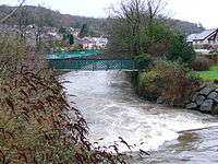
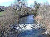
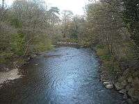
Since the closure of the last of the coal mines in the late 1980s, the water has become a lot cleaner and is now full of fish and insect life and supports plenty of other wildlife. The river now supports a healthy stock of Grayling and natural Brown Trout, and a lot of work has been undertaken to remove former industrial restrictions on the river to allow the fish to gain access to its upper reaches.[4] The river is in the care of the Environment Agency Wales and the South East Wales Rivers Trust.[1]
References
| Wikimedia Commons has media related to Rhymney River. |
- 1 2 "Rhymney River". South East Wales Rivers Trust. Retrieved 2012-05-07.
- ↑ "The History of Cardiff's Suburbs - The history of the suburb of Rumney". Cardiffians.co.uk. Retrieved 2015-01-21.
- ↑ "Rhymney river tunnel". WelshCoalMines.co.uk. Retrieved 2012-05-07.
- ↑ "Rhymney River". South East Wales Rivers Trust. Archived from the original on August 9, 2012. Retrieved 2012-05-07.
External links
Coordinates: 51°29′N 3°07′W / 51.483°N 3.117°W