Ribiers
| Ribiers | ||
|---|---|---|
|
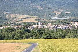
A view of the village of Ribiers from the Mison road | ||
| ||
 Ribiers | ||
|
Location within Provence-A.-C.d'A. region  Ribiers | ||
| Coordinates: 44°13′55″N 5°51′26″E / 44.2319°N 5.8572°ECoordinates: 44°13′55″N 5°51′26″E / 44.2319°N 5.8572°E | ||
| Country | France | |
| Region | Provence-Alpes-Côte d'Azur | |
| Department | Hautes-Alpes | |
| Arrondissement | Gap | |
| Canton | Ribiers | |
| Intercommunality | Ribiers Val de Méouge | |
| Government | ||
| • Mayor (2008–2014) | Robert Veret | |
| Area1 | 36.55 km2 (14.11 sq mi) | |
| Population (2008)2 | 777 | |
| • Density | 21/km2 (55/sq mi) | |
| Time zone | CET (UTC+1) | |
| • Summer (DST) | CEST (UTC+2) | |
| INSEE/Postal code | 05118 / 05300 | |
| Elevation |
464–1,480 m (1,522–4,856 ft) (avg. 519 m or 1,703 ft) | |
|
1 French Land Register data, which excludes lakes, ponds, glaciers > 1 km² (0.386 sq mi or 247 acres) and river estuaries. 2 Population without double counting: residents of multiple communes (e.g., students and military personnel) only counted once. | ||

Ribiers is a former commune in the Hautes-Alpes department in southeastern France. On 1 January 2016, it was merged into the new commune Val Buëch-Méouge.[1]
Population
| Historical population | ||
|---|---|---|
| Year | Pop. | ±% |
| 1962 | 485 | — |
| 1968 | 481 | −0.8% |
| 1975 | 533 | +10.8% |
| 1982 | 592 | +11.1% |
| 1990 | 637 | +7.6% |
| 1999 | 677 | +6.3% |
| 2008 | 777 | +14.8% |
See also
References
- ↑ Arrêté préfectoral 27 August 2015 (French)
| Wikimedia Commons has media related to Ribiers. |
This article is issued from Wikipedia - version of the 7/20/2016. The text is available under the Creative Commons Attribution/Share Alike but additional terms may apply for the media files.