River Derwent, North East England
For other rivers called Derwent, see River Derwent (disambiguation).
| River Derwent | |
 Derwent near Allensford | |
| Country | United Kingdom |
|---|---|
| County | Northumberland, County Durham, Tyne and Wear |
| Mouth | |
| - location | River Tyne |
| - coordinates | 54°57′49″N 1°40′46″W / 54.9635°N 1.6794°WCoordinates: 54°57′49″N 1°40′46″W / 54.9635°N 1.6794°W |
 Location of mouth within NE England | |
The River Derwent is a river on the border between County Durham and Northumberland in the north east of England. It broadens into the Derwent Reservoir, west of Consett. The Derwent is a tributary of the River Tyne, which it joins near the MetroCentre. The river flows for 35 miles from its origin, where two streams, Beldon Burn and Nookton Burn meet approximately a mile west of Blanchland, to Derwenthaugh where it flows into the River Tyne. On its journey, the river flows through places such as Allensford, Shotley Bridge, Blackhall Mill and Rowlands Gill. The Derwent Walk Country Park at Rowlands Gill is named after the river.
The name Derwent comes from the Brythonic/Early Welsh word for oak derw and valley -went ,[1]
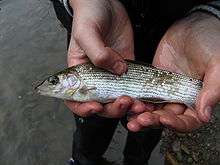
A grayling caught on the River Derwent
References
- ↑ alternatively water dour / der/ dar and white (g)-went. See under DUR http://freepages.genealogy.rootsweb.ancestry.com/~pbtyc/Misc/Etymology.html
External links
| Wikimedia Commons has media related to River Derwent, North East England. |
This article is issued from Wikipedia - version of the 6/3/2016. The text is available under the Creative Commons Attribution/Share Alike but additional terms may apply for the media files.