River Smite
| River Smite | |
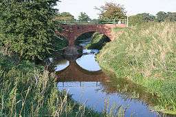 Smite near Shelton | |
| Country | England |
|---|---|
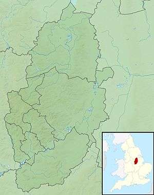
| Counties | Leicestershire, Nottinghamshire |
| Source | |
| - location | Holwell, Leicestershire |
| Mouth | |
| - location | Shelton, Nottinghamshire |
| - coordinates | 52°59′50″N 0°49′25″W / 52.9972°N 0.8235°WCoordinates: 52°59′50″N 0°49′25″W / 52.9972°N 0.8235°W |
| Length | 32 km (20 mi) [1] |
| Basin | 193 km2 (75 sq mi) [1] |
 Mouth of the Smite in Nottinghamshire | |
| Wikimedia Commons: River Smite | |
| Progression : Smite—Devon—Trent—Humber | |
The River Smite is a tributary of the River Devon, that flows for 20 miles (32 km) through Leicestershire and Nottinghamshire, England. The source is to be found near to the hamlet of Holwell, in Leicestershire and it joins the River Devon near Shelton. The Smite and its tributaries, which include the River Whipling, the Stroom Dyke, and the Dalby Brook, drain an area of 193 square kilometres (75 sq mi) of agricultural land in the Vale of Belvoir.
Name
In the 17th century the river was known as the Snite, this and the modern spelling are thought to derive from the Old English word 'Smita' denoting a 'foul or miry place', which is linked to another OE word 'Smitan', which means to daub or pollute. This indicates that the name Smite means 'the dirty, miry stream.'[2][3]
Sources
The river originates from a number of springs near Holwell in Leicestershire, which have arisen from a spring line that occurs where the local permeable ironstone meets the lower mudstones, on the flank of the Bleak Hills, which is part of the Belvoir Ridge. Although the source of the Smite is also attributed to another spring 1 km to the north, it is often stated as being Holwell mouth a chalybeate, mineral spring. This lies in a wooded ravine to the north of Holwell, and is now unused, but in the 17th and 18th centuries the water from the spring was considered to have healing properties, and was laid out with stone seating for those that took the waters. The spring contains iron salts, which gives it a reddish colour, and it is considered to have a distinctive sulphur taste. The name Holwell is of Saxon origin, meaning "the spring or stream in a hollow".[4][5][6][7]
Course
The various tributary streams that descend from the Bleak Hills join the Smite as it flows in a north-westerly direction, before it turns north-east as it reaches the bottom of the escarpment and the lower lying Vale of Belvoir. It is spanned by an aqueduct of the Grantham Canal, and then continues in a north-westerly direction, where it meets Dalby brook. This tributary drains the south-west of the catchment, rising near Old Dalby, before flowing between Upper and Nether Broughton, and past Hickling to the junction with the Smite. Beyond this confluence the river flows through Colston Bassett and beside Wiverton Hall, where it is joined by the Stroom Dyke. It continues through farmland, until it reaches the A52 where it then passes between the villages of Whatton in the Vale and Aslockton. It is joined by the River Whipling, as it flows past the remains of the motte and bailey of Aslockton Castle. The river continues in a north-easterly direction, flowing beside the villages of Orston, Thoroton, Flawborough and then Shelton where it meets the River Devon.[8]
River Whipling

The River Whipling is the main tributary of the River Smite, and is 6 miles (9.7 km) long. The source of the river is the confluence of its two tributaries, the Rundle Beck and The Grimmer which meet near Granby. The Whipling then flows around the village, before taking a north-easterly course to join the Smite near Whatton in the Vale. The Whipling and its tributaries drain an area of 52 square kilometres (20 sq mi) of the Vale of Belvoir, and so contribute approximately a quarter of the catchment area of the Smite.[1][8][9]
References
- 1 2 3 "WFD Surface Water Classification Status and Objectives 2012 csv files". Environment-agency.gov.uk. Retrieved 20 April 2014.
- ↑ Mutschmann, Heinrich (2012). The Place-Names of Nottinghamshire: Their Origin and Development. Cambridge University Press. p. 124. ISBN 9781107665415.
- ↑ "A History of Colston Bassett (1942)". Nottinghamshire History. nottshistory.org.uk. Retrieved 20 June 2014.
- ↑ Harrison, William (1882). Geology of the counties of England and of North and South Wales. Kelly. p. 157.
- ↑ "Vale of Belvoir – Section 1". Countryside Appraisal. Nottinghamshire County Council. Retrieved 14 November 2014.
- ↑ "Holwell Mouth". The Megalithic Portal. megalithic.co.uk. Retrieved 14 May 2014.
- ↑ David Mills (20 October 2011). A Dictionary of British Place-Names. Oxford University Press. pp. 244–. ISBN 978-0-19-960908-6.
- 1 2 "Water Framework Directive - River Basin Management Plans". What's in your Backyard. Environment Agency. Retrieved 14 November 2014.
- ↑ "Water Framework Directive - River Basin Management Plans". What's in your Backyard. Environment Agency. Retrieved 14 November 2014.