Rmeileh
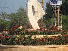
Rmeileh is a Lebanese local authority, located in the Chouf District of Lebanon. It is a municipality, belonging to the Federation of North Iqlim El Kharroub Municipalities within the Chouf District (Mount Lebanon Governorate), located approximately 37 km (about 23 miles) south of Lebanon´s capital city, Beirut.[1] It is located approximately 5.5 km (about 3 miles) north of Sidon. The population of Rmeileh is about 3,300 and it is 40 meters above sea level, rising to an altitude of 100 meters. Rmeileh wraps around the hills close to the beach and the sea to form a natural barrier before reaching the banks of the Awali River. It is bordered to the south by the towns of Elman and Jamilla, to the east by Wardaniyeh town, and to the north by the town of Dublin.
Name of the town
Rmeileh most likely got its name from the nature and location of its sandy beach. In Greek, it is known as Polatamos, but in the Syriac language, the name is derived from the word Armela meaning 'beach'.
History of Rmeileh
Throughout its history, Rmeileh has been important because of its location and proximity to Sidon. The city is known historically to have witnessed hordes of invaders and adventurers passing from Tills and other countries. Its peoples on its territory, especially when mentioned her name in Greek Palatamos conflict between Antiochus III the Great Greyhound and opponents of the Ptolemies of Egypt. There are also many effects belonging to these peoples, especially Phoenician, Greek and Roman.In the late Middle Ages, Rmeileh took the strategy to cross Sidon to the country and the Chouf station combatants crossing in both directions.
The ancient town of Rmeileh is built over the hill near the sea and was located near the modern church. At the bottom and towards the left, we find Mgartan of the Phoenician era, they are at the top of the hill caves suggest a settlement on this site since the earliest historical times. Renan was noted during his mission to Phoenicia regarding the importance of the effects of the Rmeileh and said that the site is enriched with Old ancient ruins of the city which has been seen in the village at that time when he visited in 1863 impact. He found a rock,which he named"unique" which is a rock length of 3.6 m. punctuated cavity to have encountered is based on the parties bases square rooms and broken rock Egyptian style has been to maintain this rock, despite the construction of a home for the family of the town. And spread throughout the town cut from stone sarcophagi from different eras and a number of caves where excavators found pieces "of pottery and tools, glass and various currencies were also found on the sandy beach of the town on the ancient walls built of sandstone and inside panels of the mosaic of broken-like similar Nearby places discoveries Rmeileh, particularly in Jiyeh and Khaldeh, Sidon and Chehim Perhaps this beach has gained great importance since ancient times as the headquarters of the establishment of the nobles and leaders in the Roman era.
In high-known town land Dhor Rmeileh old landfills are no different shapes and rocks dug wells, Renan has arrived in this place and her uncle she Marvin Necropole city where private landmarks.

Tourism of Rmeileh
- Archaeological and historical monuments:
- the effects of the old town: the old town over the nearby hill from the beach constructed by the old church and spread throughout the town are many sandy and rocky stones that were used in the construction, and this indicates that it indicates the existence of an ancient settlement existed on this hill and disappeared landmarks under modern buildings
- archaeological cemeteries: spread in the town and its environs a large number of archeological tombs carved in the rock, notably those near the modern church and appointed Gemmaiza
- Religious monuments:
- Church of the Old City: Located near the new church to the east, a rectangular building 17 m in length and width and height of the 12:00 20:00. In front of a small courtyard to the north and above it a small bell tower
- Modern Church: and it is known as the Church of Saint Anthony the Great is a modern church built about fifty years ago located in the center of town and is characterized by large size and beautiful icons that adorn it.
- Mar Elias shrine: Located in the far southern Albparty of the town, on the north bank of the River initial amid lemon groves and cultivated land with vegetables. It is a small room in front of the open courtyard of the worshipers.
- Natural features:
- cave Beaufort is located near the eye Gemmaiza which is a huge cave formed by General oval and consists of calcareous rocks of similar archaeological Bmgarh Adloun
- spring eye Gemmaiza: Located at the bottom of the valley to the south of the town which is about Nabah engraved rock and is currently working on the restoration of municipal and visibility as an attraction.

Important economic products
Vegetables of all kinds including: Almkhovh, olives, olive oil, citrus fruits, bananas, guava.
References
- ↑ Localiban. "Rmeileh (Chouf)". www.localiban.org. Retrieved 2016-05-17.