Robeston Wathen
| Robeston Wathen | |
 St Andrew's Church, Robeston Wathen |
|
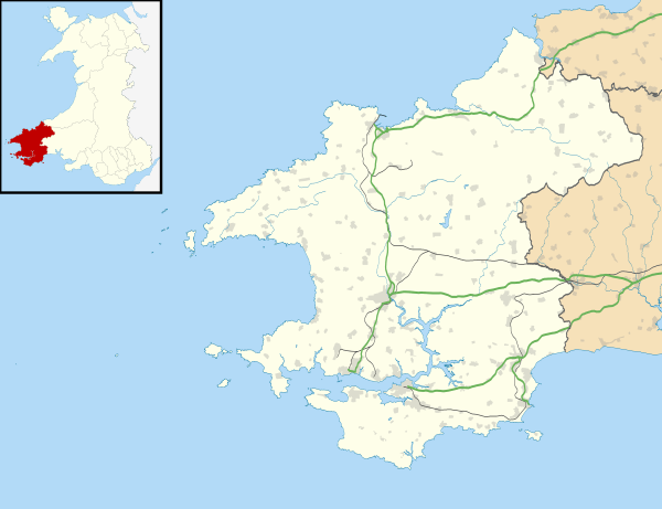 Robeston Wathen |
|
| OS grid reference | SN0815 |
|---|---|
| Community | Llawhaden |
| Principal area | Pembrokeshire |
| Country | Wales |
| Sovereign state | United Kingdom |
| Post town | Narberth |
| Postcode district | SA67 |
| Police | Dyfed-Powys |
| Fire | Mid and West Wales |
| Ambulance | Welsh |
| EU Parliament | Wales |
| UK Parliament | Carmarthen West and South Pembrokeshire |
| Welsh Assembly | Carmarthen West and South Pembrokeshire |
|
|
Coordinates: 51°48′22″N 4°46′52″W / 51.806°N 4.781°W
Robeston Wathen is a rural village and parish in Pembrokeshire, Wales, 2 miles (3.2 km) west of Narberth, on the former Narberth to Haverfordwest turnpike subsequently designated the A40 which bypassed the village in 2011. Robeston Wathen is in the community of Llawhaden.
The village is mediaeval, and limestone was quarried there.
Name
The village was recorded as "Villa Roberti" in 1282,[1] referring to an unknown Robert. It was referred to as "Roberdeston" (meaning: Robert's Farm) in 1357 and "Robertson Wathen" in 1545. The suffix "Wathen" came from the Wathen family who occupied the manor from the 15th century,[2] and the origin of the name Wathen comes from the personal name Gwaiddan.[3]
History
The parish has evidence of Neolithic and Bronze Age occupation, discovered during the building of the bypass (see below).[4] In Norman times Robeston Wathen was in the ancient administrative area of Narberth Hundred.[5]
Robeston House (or Robeston Wathen House), of uncertain date but at least as early as 1800, is a Grade II listed building;[6] it was a hotel from 1977 to 1999.[7] In 1833 the parish[8] had a population of 421.[5] A school was started in the 1860s for 90 local children. It closed in 1971 and is now the village hall.[2]
Wilson's Gazeteer of 1872 describes the parish as covering 1,345 acres (544 ha) with a population of 362 living in 92 houses.[9]
Limestone was quarried at Robeston Wathen Quarries, now a Site of Special Scientific Interest. It was designated a SSSI in 1967 to protect its fragile geological elements: the limestone is extremely rich in corals, particularly halysitids, and contains rare brachiopods. The site covers 1.67 ha and is managed by Natural Resources Wales.[10] Some of the houses in the village are built from stone quarried there.[2]
The Robeston Wathen Village Association was founded in 1989.[2]
Until 2011 the main A40 trunk road passed through the village, effectively cutting it in two. The bypass was completed at a cost of £41 million and opened in March 2011. Access to Robeston Wathen village is by roundabouts to the east and west of the village.[11]
Amenities

The village has a petrol station and garage with an integral shop. To the west of the village is The Bush Inn, formerly a small cottage inn, which has become a larger concern[12] and to the southeast at Coxlake is The Bridge, an inn on the Robeston Wathen to Narberth road, now the B4314.
Church
The parish is in the Diocese of St David's and the parish church is dedicated to St Andrew. It was rebuilt in the 19th century on its mediaeval foundations;[13] the tower is 14th or 15th century.[14] It is a Grade II listed building.[15]
In the churchyard is the war memorial to those who lost their lives in two world wars.[16]
References
- ↑ "Dyfed Archaeological Trust: Excavations on the A40 bypass at Robeston Wathen" (PDF). Retrieved 14 May 2015.
- 1 2 3 4 "Robeston Wathen Action Plan". Retrieved 15 May 2015.
- ↑ Mills, A. D. (2011). A Dictionary of British Place Names. Oxford University Press. ISBN 9780199609086. Retrieved 15 May 2015. (subscription required (help)).
- ↑ "Dyfed Archaeological Trust". Retrieved 14 May 2015.
- 1 2 "GENUKI: Robeston Wathen". Retrieved 14 May 2015.
- ↑ "British Listed Buildings: Robeston House". Retrieved 15 May 2015.
- ↑ "Coflein: Robeston Wathen House". Retrieved 15 May 2015.
- ↑ "GENUKI: Parish map (No.114)". Retrieved 15 May 2015.
- ↑ "Vision of Britain: Robeston Wathon (sic)". Retrieved 15 May 2015.
- ↑ "Robeston Wathen Quarries". Retrieved 15 May 2015.
- ↑ "CIHT: Site visit". Retrieved 14 May 2015.
- ↑ "PubsCymru: The Bush Inn, Robeston Wathen". Retrieved 14 May 2015.
- ↑ Lewis, Samuel (1849). A Topographical Dictionary of Wales. p. 356-368. Retrieved 15 May 2015.
- ↑ "Stained glass in Wales". Retrieved 15 May 2015.
- ↑ "British Listed Buildings: Robeston Wathen Church". Retrieved 15 May 2015.
- ↑ "Robeston Wathen War Memorial". Retrieved 14 May 2015.
External links
| Wikimedia Commons has media related to Robeston Wathen. |