Rosa Panduro District
| Rosa Panduro | |
|---|---|
| District | |
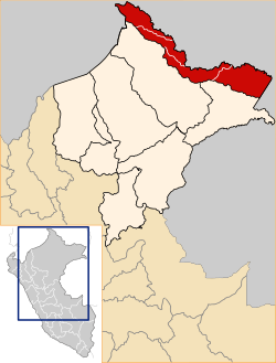 Location of Rosa Panduro in the Putumayo Province | |
| Coordinates: 1°47′47″S 73°24′28″W / 1.79639°S 73.40778°WCoordinates: 1°47′47″S 73°24′28″W / 1.79639°S 73.40778°W | |
| Country |
|
| Region | Loreto |
| Province | Putumayo |
| Created | April 10, 2014 |
| Capital | Santa Mercedes |
| Subdivisions | 1 populated center |
| Government | |
| • Mayor |
Delmer Ricopa (2016-2018) |
| Area | |
| • Total | 7,166.65 km2 (2,767.06 sq mi) |
| Elevation | 34 m (112 ft) |
| Population (2014 census) | |
| • Total | 729 |
| • Density | 0.10/km2 (0.26/sq mi) |
| Time zone | PET (UTC-5) |
| UBIGEO | 160802 |
| Website | www.munirosapanduro.gob.pe |
Rosa Panduro is a district of the Putumayo Province in Peru, and one of the four districts that comprise that province.
History
Rosa Panduro was part of Maynas Province until April 17, 2014 when it was created as District by Law N° 30186 as part of Putumayo Province.[1]
Geography
The district has a total land area of 7 155,65 km². Its administrative center is located 34 meters above sea level.
Boundaries
- By the north: Teniente Manuel Clavero District;
- By the est: Colombia Republic;
- By the south and sudwest: Putumayo District and, Napo District and Torres Causana District (Maynas Province).
Authorities
The current mayor of the district is Delmer Ricopa Coquinche (Movimiento Integración Loretana).[2]
See also
References
External links
- Municipalidad Distrital de Rosa Panduro - City council official website (in Spanish)
- INEI Peru (in Spanish)
This article is issued from Wikipedia - version of the 4/30/2016. The text is available under the Creative Commons Attribution/Share Alike but additional terms may apply for the media files.