Roselend Dam
| Roselend Dam | |
|---|---|
 | |
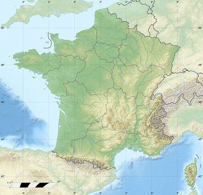 Location of Roselend Dam in France | |
| Official name | Barrage de Roselend |
| Country | France |
| Location | Beaufort |
| Coordinates | 45°41′03″N 6°37′18″E / 45.68417°N 6.62167°ECoordinates: 45°41′03″N 6°37′18″E / 45.68417°N 6.62167°E |
| Status | Operational |
| Construction began | 1955 |
| Opening date | 1962 |
| Dam and spillways | |
| Type of dam | Arch-buttress dam |
| Height | 150 m (492 ft) |
| Length | 804 m (2,638 ft) |
| Width (crest) | 3 m (10 ft) |
| Width (base) | 22 m (72 ft) |
| Dam volume | 945,000 m3 (1,236,013 cu yd) |
| Reservoir | |
| Creates | Lac de Roselend |
| Total capacity | 187,000,000 m3 (151,603 acre·ft) |
| Catchment area | 44 km2 (17 sq mi) |
| Surface area | 3.2 km2 (1 sq mi) |
| Normal elevation | 1,557 m (5,108 ft)[1] |
| Power station | |
| Name | La Bâthie Power Station |
| Coordinates | 45°38′41″N 6°26′40″E / 45.64472°N 6.44444°E |
| Commission date | 1962 |
| Type | Conventional, diversion |
| Hydraulic head | 1,250 m (4,101 ft)[2] |
| Turbines | 6 x 91 MW Pelton-type |
| Installed capacity | 546 MW |
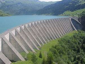
The Roselend Dam is an arch-buttress dam located 5 km (3 mi) east of Beaufort in the Savoie department of the Rhône-Alpes region in south-eastern France. It is located just west and below the Cormet de Roselend mountain pass. The dam was designed by Coyne et Bellier and construction began in 1955. The reservoir began to fill in 1960, the power station was operational in 1961 and the dam complete in 1962. It was constructed for the primary purpose of hydroelectric power generation and supports the 546 MW La Bâthie Power Station.[3]
Design and operation
The dam has a maximum height of 150 m (492 ft) and a length of 804 m (2,638 ft). It is 3 m (10 ft) wide at its crest and 22 m (72 ft) wide at its base. The dam has a structural volume of 945,000 m3 (1,236,013 cu yd). Its reservoir, Lac de Roselend, can store 187,000,000 m3 (151,603 acre·ft) of water and has a surface area of 3.2 km2 (1 sq mi). Directly over the river bed is the dam's concrete arch with a 215 m (705 ft) radius. Flanking it on either side are concrete buttresses supporting the dam wall.[4][5] Water from the dam is transferred west via a 13 km (8 mi) long penstock to the underground power station in La Bâthie. At the power station, the water feeds six 91 MW Pelton turbine-generators. The difference in elevation between the power station and reservoir affords a hydraulic head (drop) of 1,250 m (4,101 ft).[6] Water from the St. Guerin Dam, 5 km (3 mi) to the southwest at 45°39′00″N 6°34′46″E / 45.65000°N 6.57944°E and Gittaz Dam, 4.5 km (3 mi) to the northeast at 45°42′40″N 6°38′46″E / 45.71111°N 6.64611°E, provide additional water to Lac de Roseland as well.[3][7]
References
- ↑ "Bathie (La) Hydroelectric Power Station". Global Energy Observatory. Retrieved 16 March 2012.
- ↑ "Roselend dam" (in French). Hydrelect. Retrieved 16 March 2012.
- 1 2 "Roselend" (PDF). The Sunflower Project. Retrieved 16 March 2012.
- ↑ "Roselend Dam". Structurae. Retrieved 16 March 2012.
- ↑ "Roselend" (in French). French Committee on Large Dams. Retrieved 16 March 2012.
- ↑ "Roselend near Albertville in Savoie (1960)" (in French). Planete-TP. Retrieved 16 March 2012.
- ↑ "Hydroelectric Plants in France - Rhône-Alpes". IndustCards. Retrieved 16 March 2012.
| Wikimedia Commons has media related to Barrage de Roselend. |