Roter Kogel
| Roter Kogel | |
|---|---|
 | |
| Highest point | |
| Elevation | 2,832 m (9,291 ft) |
| Coordinates | 47°08′00″N 11°10′0″E / 47.13333°N 11.16667°ECoordinates: 47°08′00″N 11°10′0″E / 47.13333°N 11.16667°E |
| Geography | |
| Location | Tyrol, Austria |
| Parent range | Stubai Alps |
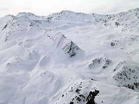
The Roter Kogel is a mountain, 2,832 m (AA), in the Stubai Alps in the Austrian state of Tyrol.
It lies on a ridge that runs from the Hohe Villerspitze over the Lüsener Villerspitze (3,027 m (AA)) northwards as far as the Fotscher Windegg (2,577 m (AA)). West of this chain lies the Lüsener Valley and the village of Praxmar, a starting point for an ascent of the Roter Kogel. East of the Roter Kogels stretches the valley of Fotscher Tal, where there are two other bases: the Alpengasthof Bergheim Fotsch (1,464 m (AA)) and the Potsdamer Hut. This ascent up the eastern side is also a popular ski tour in winter.
Literature
- Heinrich und Walter Klier, Alpenvereinsführer Stubaier Alpen, Bergverlag Rudolf Rother, München 1988. ISBN 3-7633-1252-8
This article is issued from Wikipedia - version of the 2/22/2015. The text is available under the Creative Commons Attribution/Share Alike but additional terms may apply for the media files.