Royal Company's Islands
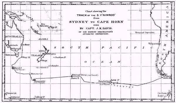
1909 search for Royal Company and other phantom islands
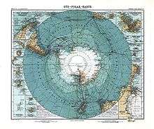
1912 German map showing Royal Company Islands southwest of Tasmania
The Royal Company's Islands are a group of phantom islands reported by some early explorers to lie southwest of Tasmania. They were first heard of before 1840, but the original report cannot be traced. Many old charts show them at 50°20′S 140°0′E / 50.333°S 140.000°E or 52°20′S 143°0′E / 52.333°S 143.000°E.
The islands' existence was disproved as early as 1840 by the United States Exploring Expedition.[1] From 1889 to 1902 several vessels passed through the islands' vicinity without noting any landforms, and in 1904 the UK Hydrographic Office finally decided to remove them from all Admiralty charts.[2][3] Further searches by the Nimrod in 1909 and the Aurora in 1912 turned up nothing.[4][5]
References and sources
- References
- ↑ "The Antarctic Continent". Hobart Courier. Jan 12, 1841. p. 3. Retrieved May 6, 2009.
They sailed over the supposed place of the Royal Company's Islands, disproving their existence.
- ↑ "Expunged Islands" (PDF). The Emu. 4: 32. July 1904. doi:10.1071/MU904032a.
- ↑ "The Phantom Isles of the Pacific". New York Times. May 15, 1904. p. 11. Retrieved May 6, 2009.
- ↑ Davis, J.K. (Dec 1910). "Voyage of the S. Y. "Nimrod.": Sydney to Monte Video Viâ Macquarie Island, May 8-July 7, 1909". The Geographical Journal. Blackwell Publishing. 36 (6): 696–703. doi:10.2307/1776845. JSTOR 1776845.
- ↑ Mawson, Douglas (n.d.). "Chapter 18: The Ship's Story". The Home of the Blizzard, being the story of the Australasian Antarctic expedition, 1911-1914. London: Ballantyne Press.
Royal Company Islands not found in the position indicated on the chart
- Sources
- Bayldon, Francis J. (July 1935). "The royal company islands". Australian Geographer. 2 (7): 27–30. doi:10.1080/00049183508702139.
External links
This article is issued from Wikipedia - version of the 7/20/2015. The text is available under the Creative Commons Attribution/Share Alike but additional terms may apply for the media files.