Rumpi Hills
| Rumpi Hills | |
|---|---|
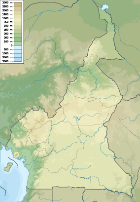 Rumpi Hills Location in Cameroon | |
| Highest point | |
| Elevation | 1,768 m (5,801 ft) |
| Coordinates | 4°50′0″N 9°07′0″E / 4.83333°N 9.11667°ECoordinates: 4°50′0″N 9°07′0″E / 4.83333°N 9.11667°E |
| Geography | |
| Location | Cameroon |
| Parent range | Cameroon line |
The Rumpi Hills in the Southwest Region of Cameroon are about 80 kilometres (50 mi) north of Mount Cameroon, and include the Rumpi Hills Wildlife Reserve.[1][2]
The Rumpi Hills cover about 1,500 square kilometres (580 sq mi) in an area of Precambrian metamorphic and intrusive rocks cut by Cainozoic intrusive complexes and widely overlain by volcanoes from the Cainozoic, the highest of which is Mount Rata at 1,768 metres (5,801 ft).[1] There are no classic volcano cones with craters, since many of the peaks have been caused by extensive faulting.[2]
The hills contain mid-altitude forest, which has been widely damaged by logging and farming, as well as coastal evergreen and drier northern semi-evergreen forest. Hunters have reported seeing the endangered drill and Preuss's monkey. 198 species of birds have been identified, including the endangered white-throated mountain-babbler.[2] The Mungo River rises in these hills, flowing east and then south to the Cameroon estuary.[3]
References
- 1 2 Alan Robert Woolley (2001). Alkaline rocks and carbonatites of the world, Part 3. Geological Society. p. 37. ISBN 1-86239-083-5.
- 1 2 3 "Mount Rata and Rumpi Hills Forest Reserve". BirdLife International. Retrieved 2011-02-11.
- ↑ Bernard P.K. Yerima, E. Van Ranst (2005). Major Soil Classification Systems Used in the Tropics:: Soils of Cameroon. Trafford Publishing. p. 144. ISBN 1-4120-5789-2.