Rupite Glacier

Location of Smith Island in the South Shetland Islands.
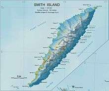
Topographic map of Smith Island.
Rupite Glacier (Bulgarian: ледник Рупите, ‘Lednik Rupite’ \'led-nik 'ru-pi-te\) is a 2.9 km long glacier on Smith Island, South Shetland Islands draining the southeast slopes of Imeon Range east of the summit Mount Foster and southeast of Evlogi Peak. It is situated southeast of Chuprene Glacier, southwest of Pashuk Glacier and northeast of Landreth Glacier, and flows southeastward into Osmar Strait. Bulgarian early mapping in 2008. The glacier is named after the settlement Rupite and the nearby protected area in southwestern Bulgaria.
Coordinates: 63°00′05″S 62°31′00″W / 63.00139°S 62.51667°W
Maps
- L.L. Ivanov. Antarctica: Livingston Island and Greenwich, Robert, Snow and Smith Islands. Scale 1:120000 topographic map. Troyan: Manfred Wörner Foundation, 2009. ISBN 978-954-92032-6-4
References
This article includes information from the Antarctic Place-names Commission of Bulgaria which is used with permission.
This article is issued from Wikipedia - version of the 11/14/2016. The text is available under the Creative Commons Attribution/Share Alike but additional terms may apply for the media files.