Rustenburg Airfield
| Rustenburg Airfield | |||||||||||
|---|---|---|---|---|---|---|---|---|---|---|---|
| IATA: none – ICAO: FARG | |||||||||||
| Summary | |||||||||||
| Airport type | Public | ||||||||||
| Owner | Rustenburg Municipality | ||||||||||
| Operator | Rustenburg Flying Club | ||||||||||
| Serves | Rustenburg, North West, South Africa | ||||||||||
| Elevation AMSL | 3,700 ft / 1,128 m | ||||||||||
| Coordinates | 25°38′39″S 027°16′16″E / 25.64417°S 27.27111°ECoordinates: 25°38′39″S 027°16′16″E / 25.64417°S 27.27111°E | ||||||||||
| Map | |||||||||||
 FARG Location of airport in North West province Location of North West in South Africa 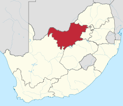 | |||||||||||
| Runways | |||||||||||
| |||||||||||
Rustenburg Airfield (ICAO: FARG), licensed according to South African Civil Aviation Authority standards,[1] is a municipal airport situated near Rustenburg in the North West province of South Africa.
Facilities
The airport resides at an elevation of 3,700 feet (1,128 m) above mean sea level. It has one runway designated 16/34 with an asphalt surface measuring 1,224 by 15 metres (4,016 ft × 49 ft).
Communication
The Communication Frequency for Rustenburg Airfield is 122.4 [2]
Rustenburg SkyDiving Club
Licensed under the Parachute Association of South Africa, Rustenburg Skydiving Club,[3] operates a Turbine Atlas Angel to 12,000 ft AGL (flight level 16,500 AMSL) every weekend within a 3-nautical-mile (5.6 km) radius of the drop zone. A facility for sports skydiving and parachuting, performing Tandem SkyDiving, First Jump Courses, Accelerated Freefall (AFF) Programs, Static Line Jumps, Student and Intermediary Freefall and Canopy Progression Programs, Canopy Control Courses and Canopy Formation SkyDiving Coaching.[4]
Nearby airports
Nearby attractions
- Sun City
- Pilanesburg Game Reserve
- SkyDive Rustenburg[4]
See also
References
- ↑ South African Civil Aviation Authority, CAA website link retrieved 14 March 2010
- ↑ AVIMAP Frequency Chart March 2009
- ↑ Parachute Association of South Africa, Parachute Association of South Africa website link retrieved 14 March 2010
- 1 2 SkyDive Rustenburg, SkyDive Rustenburg website link retrieved 14 March 2010