Saint-Herblon
| Saint-Herblon | ||
|---|---|---|
|
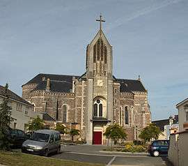
The church of Saint-Hermeland, in Saint-Herblon | ||
| ||
 Saint-Herblon | ||
|
Location within Pays de la Loire region  Saint-Herblon | ||
| Coordinates: 47°24′33″N 1°05′41″W / 47.4092°N 1.0947°WCoordinates: 47°24′33″N 1°05′41″W / 47.4092°N 1.0947°W | ||
| Country | France | |
| Region | Pays de la Loire | |
| Department | Loire-Atlantique | |
| Arrondissement | Ancenis | |
| Canton | Ancenis | |
| Intercommunality | Pays d'Ancenis | |
| Government | ||
| • Mayor (2008–2014) | Gérard Barrier | |
| Area1 | 36.9 km2 (14.2 sq mi) | |
| Population (1999)2 | 1,842 | |
| • Density | 50/km2 (130/sq mi) | |
| Time zone | CET (UTC+1) | |
| • Summer (DST) | CEST (UTC+2) | |
| INSEE/Postal code | 44163 / 44150 | |
| Elevation |
5–80 m (16–262 ft) (avg. 91 m or 299 ft) | |
|
1 French Land Register data, which excludes lakes, ponds, glaciers > 1 km² (0.386 sq mi or 247 acres) and river estuaries. 2 Population without double counting: residents of multiple communes (e.g., students and military personnel) only counted once. | ||
.svg.png)
Saint-Herblon is a former commune in the Loire-Atlantique department in western France. On 1 January 2016, it was merged into the new commune of Vair-sur-Loire.[1]
See also
References
- ↑ Arrêté préfectoral 29 October 2015
| Wikimedia Commons has media related to Saint-Herblon. |
This article is issued from Wikipedia - version of the 3/8/2016. The text is available under the Creative Commons Attribution/Share Alike but additional terms may apply for the media files.