Saint-Léonard-de-Portneuf
| Saint-Léonard-de-Portneuf | |
|---|---|
| Municipality | |
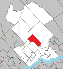 Location within Portneuf RCM. | |
 Saint-Léonard-de-Portneuf Location in central Quebec. | |
| Coordinates: 46°53′N 71°55′W / 46.883°N 71.917°WCoordinates: 46°53′N 71°55′W / 46.883°N 71.917°W[1] | |
| Country |
|
| Province |
|
| Region | Capitale-Nationale |
| RCM | Portneuf |
| Constituted | July 22, 1899 |
| Government[2] | |
| • Mayor | Denis Langlois |
| • Federal riding | Portneuf—Jacques-Cartier |
| • Prov. riding | Portneuf |
| Area[2][3] | |
| • Total | 146.40 km2 (56.53 sq mi) |
| • Land | 140.60 km2 (54.29 sq mi) |
| Population (2011)[3] | |
| • Total | 1,019 |
| • Density | 7.2/km2 (19/sq mi) |
| • Pop 2006-2011 |
|
| • Dwellings | 635 |
| Time zone | EST (UTC−5) |
| • Summer (DST) | EDT (UTC−4) |
| Postal code(s) | G0A 4A0 |
| Area code(s) | 418 and 581 |
| Highways |
|
| Website |
www st-leonard |
Saint-Léonard-de-Portneuf is a municipality in the Capitale-Nationale region of Quebec, Canada.
Demographics
Population trend:[4]
- Population in 2011: 1019 (2006 to 2011 population change: -2.6 %)
- Population in 2006: 1046
- Population in 2001: 1010
- Population in 1996: 988
- Population in 1991: 997
Private dwellings occupied by usual residents: 449 (total dwellings: 635)
Mother tongue:
- English as first language: 0%
- French as first language: 98.1%
- English and French as first language: 0%
- Other as first language: 1.9%
References
- ↑ Reference number 57069 of the Commission de toponymie du Québec (French)
- 1 2 Ministère des Affaires municipales, des Régions et de l'Occupation du territoire - Répertoire des municipalités: Saint-Léonard-de-Portneuf
- 1 2 Statistics Canada 2011 Census - Saint-Léonard-de-Portneuf census profile
- ↑ Statistics Canada: 1996, 2001, 2006, 2011 census
 |
Rivière-à-Pierre | Saint-Raymond | | |
| Portneuf (northern section) | |
Saint-Raymond | ||
| ||||
| | ||||
| Sainte-Christine-d'Auvergne |
| Cities & towns | |
|---|---|
| Municipalities | |
| Parishes | |
| Unorganized territories | |
| |
This article is issued from Wikipedia - version of the 1/25/2014. The text is available under the Creative Commons Attribution/Share Alike but additional terms may apply for the media files.