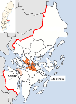
Salem Municipality
| Salems kommun | ||
|---|---|---|
| Municipality | ||
| ||
 | ||
| Country | Sweden | |
| County | Stockholm County | |
| Seat | Salem | |
| Area[1] | ||
| • Total | 71.09 km2 (27.45 sq mi) | |
| • Land | 54.09 km2 (20.88 sq mi) | |
| • Water | 17 km2 (7 sq mi) | |
| Area as of January 1, 2014. | ||
| Population (June 30, 2016)[2] | ||
| • Total | 16,577 | |
| • Density | 230/km2 (600/sq mi) | |
| Time zone | CET (UTC+1) | |
| • Summer (DST) | CEST (UTC+2) | |
| ISO 3166 code | SE | |
| Province | Södermanland | |
| Municipal code | 0128 | |
| Website | www.salem.se | |
| Density is calculated using land area only. | ||

Salem Municipality (Salems kommun) is a municipality in Stockholm County in east central Sweden. The name traces its origins from Slaem in the 16th century, but was later changed to Salem, the Biblical name of Jerusalem. Its seat is located in Salem.
History
Like the rest of the areas around Lake Mälaren, Salem has a significant amount of ancient remains, as far back as the Stone Age. The church of Salem traces its foundation to the 12th century.
Just like its eastern municipal neighbour Botkyrka, Salem traces its history back to the legendary Saint Botvid, who lived in the area sometime between 1050-1120. In the medieval tradition, a spring would always be found in connection to the death of a saint. According to legend, when the remains of Saint Botvid were transported to the church in today's Botkyrka, the casket was temporarily put down near the shore of Lake Bornsjön, where a spring poured up. It continues to provide clear water to this day.
Today
Salem was united with the municipality of Botkyrka during the Swedish municipal reform between 1971-1974. However, in 1983, after energetic protests, they were split apart, and Salem became the 14th smallest municipality by area in the country.
Salem is served by one station, Rönninge, on the commuter train line between Södertälje and Märsta via Stockholm. There are also a good network of bus lines.
The number of people in Salem is about 30% less during day time due to that it has the biggest percentage of people in Stockholm county that work outside own municipal. [3]
References
- ↑ "Statistiska centralbyrån, Kommunarealer den 1 januari 2014" (Microsoft Excel) (in Swedish). Statistics Sweden. Retrieved 2014-04-18.
- ↑ "Folkmängd i riket, län och kommuner 30 juni 2016" (in Swedish). Statistics Sweden. August 17, 2016. Retrieved August 17, 2016.
- ↑ Stockholm County Administrative Board May 2013
External links
- Salem Municipality - Official site
Municipalities and seats of Stockholm County | ||
|---|---|---|
| Municipalities | ||
| Municipal seats | ||
Coordinates: 59°12′N 17°46′E / 59.200°N 17.767°E