Salt Spring Hills
| Salt Spring Hills | |
|---|---|
 Salt Spring Hills, San Bernardino County, California. | |
| Highest point | |
| Elevation | 928 ft (283 m) |
| Geography | |
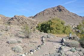
 location of Salt Spring Hills in California [1] | |
| Country | United States |
| State | California |
| Region | Mojave Desert |
| District | San Bernardino County |
| Range coordinates | 35°38′38″N 116°16′18″W / 35.6439°N 116.2717°WCoordinates: 35°38′38″N 116°16′18″W / 35.6439°N 116.2717°W |
| Topo map | USGS Saddle Peak Hills |
The Salt Spring Hills are a low mountain range in the Mojave Desert, in northern San Bernardino County, California.[1] They are just outside the southeastern corner of Death Valley National Park, southeast of the Saddle Peak Hills. The road south from Shoshone to Baker passes through the hills.
History
From 1831 to 1848, the Old Spanish Trail passed through the hills near Amargosa Spring.[2]:10–11
In 1849, when Jefferson Hunt led a Mormon party of several wagons down the Old Spanish Trail to Los Angeles, they camped at Salt Spring on Salt Creek. Some of the party discovered gold in the creek and traced it to a quartz vein in the nearby hills. The Salt Spring Hills were named for Salt Spring, on the Mormon Road that passed just west of the hills, where the gold was first found. This discovery which became known once the party reached the Rancho Santa Ana del Chino, set off the first gold rush in the Mojave Desert. Several mining companies attempted to mine the hills in the early 1850s.[3]
See also
Other ranges in the local area include the:
References
- 1 2 "Salt Spring Hills". Geographic Names Information System. United States Geological Survey. Retrieved 2009-05-04.
- ↑ Edward Leo Lyman, Overland Journey from Utah to California: Wagon Travel from the City of Saints to the City of Angels, University of Nevada Press, 2008.
- ↑ Vredenburgh, Larry M., 1994. Fort Irwin and Vicinity: History of Mining Development in Robert E. Reynolds, Off Limits in the Mojave Desert, San Bernardino County Museum Association Special Publication 94, p. 81 - 90