Salton Trough
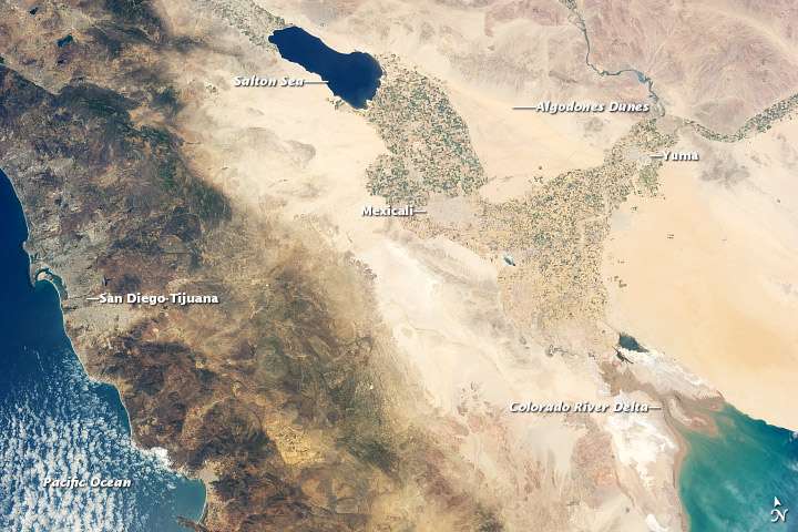
The Salton Trough region from orbit.
The Salton Trough is an active tectonic pull-apart basin. It lies within the Imperial, Riverside, and San Diego counties of southeastern California.[1]
The Salton Trough is a result of crustal stretching and sinking by the combined actions of the San Andreas Fault and the East Pacific Rise. The Salton Sink is the topographic low area within the Salton Trough. The Brawley seismic zone forms the southeast end of the basin and connects the San Andreas Fault system with the Imperial Fault Zone to the south.[2] The Salton Buttes are rhyolite lava domes within the basin which were active 10,300 (± 1000) years BP.[3]
References
- ↑ Kearey, Philip and Frederick J. Vine, Global Tectonics, Blackwell Science, 2nd ed., 1996, pp. 131-133 ISBN 0-86542-924-3
- ↑ Fuis, Cary S. and Walter D. Mooney, Salton Trough Lithospheric Structure and Tectonics from Seismic-Refraction and Other Data in USGS Professional Paper 1515]
- ↑ "Salton Buttes". Global Volcanism Program. Smithsonian Institution.
| Wikimedia Commons has media related to Salton Sink. |
This article is issued from Wikipedia - version of the 10/7/2016. The text is available under the Creative Commons Attribution/Share Alike but additional terms may apply for the media files.