San Bernardino meridian
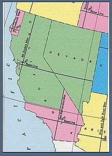
U.S. Bureau of Land Management map showing the principal meridians of California
The San Bernardino meridian, established in 1852,[1] is one of three Principal meridians in the state of California. Because of the state's shape, three meridian–baseline sets are required for surveys in all parts of the state. The San Bernardino meridian is used for Southern California, and some townships in Arizona are also referenced to it.[1]
The initial point (datum) is at the summit of Mount San Bernardino, in the San Bernardino Mountains, in San Bernardino County, California. It is at an elevation of over 10,000 feet (3,000 meters).
The meridian runs North–South from the initial point 34°07′13″N 116°55′48″W / 34.12028°N 116.93000°W.[2]
See also
References
- 1 2 Part 5: Public Land Survey System Standards for United States Geological Survey (USGS) and United States Department of Agriculture (USDA) Forest Service Single Edition Quadrangle Maps (5/03)
- ↑ US Dept. of Interior, Bureau of Land Management. Manual of Surveying Instructions 1971 Ed. Landmark Ent. ISBN 0-910845-60-3 Pg. 60
External links
- "Cadastral Survey [San Bernardino Meridian]". U.S. Bureau of Land Management. Retrieved 2012-10-06.
- "Principal Meridians and Base Lines". U.S. Bureau of Land Management. Retrieved 2012-10-06.
- "San Bernardino Principal Meridian, Washington Monument". Principal Meridian Project. Retrieved 2012-10-06.
- "San Bernardino Meridian". The Center for Land Use Interpretation. Retrieved 2012-10-06.
- "Nevada in Maps: Plats of Nevada State Lands" (Background and maps of the San Bernardino and Mt. Diablo meridians). University of Nevada, Reno. Retrieved 2012-10-06.
- Michael A. Duffy, PLS. "Three Monuments, One Initial Point" (Published in the September 2002 Issue #135 of the California Surveyor). Mount Diablo Surveyors Historical Society. Retrieved 2012-10-06.
- Michael A. Duffy, PLS. "Three Monuments, One Initial Point" (PDF) (Published in the September 2002 Issue #135 of the California Surveyor). Principal Meridian Project. Retrieved 2012-10-06.
Coordinates: 34°07′12.96″N 116°55′51.60″W / 34.1202667°N 116.9310000°W
This article is issued from Wikipedia - version of the 11/16/2015. The text is available under the Creative Commons Attribution/Share Alike but additional terms may apply for the media files.