San Francisco Mountains (Utah)
| San Francisco Mountains (Utah) | |
|---|---|
|
| |
| Highest point | |
| Peak | Frisco Peak |
| Elevation | 5,999 ft (1,828 m) |
| Coordinates | 38°31′13″N 113°17′15″W / 38.52030°N 113.2876°WCoordinates: 38°31′13″N 113°17′15″W / 38.52030°N 113.2876°W |
| Dimensions | |
| Length | 20 mi (32 km) SW x NE |
| Width | 8 mi (13 km) |
| Geography | |
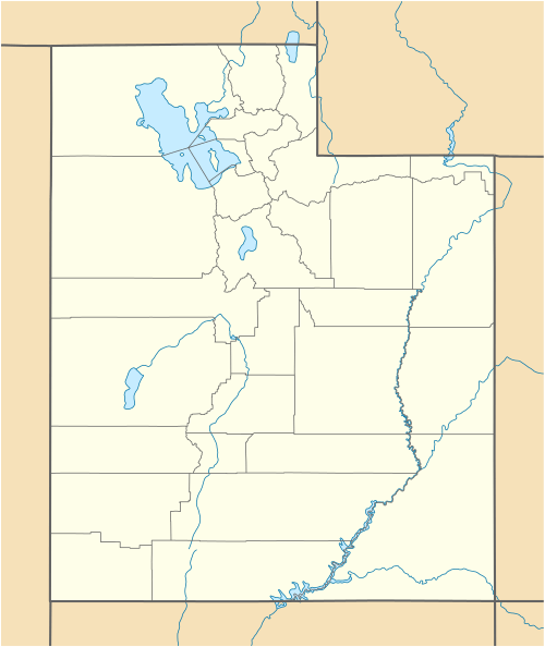 San Francisco Mountains (Utah) San Francisco Mountains in Utah | |
| Country | United States |
| State | Utah |
| Region | Great Basin Desert |
| Counties | Beaver and Millard |
| Cities | Newhouse (site) & Frisco (site) |
| Borders on |
Wah Wah Valley-SW & W Sevier Lake-N Cricket Mountains-NNE Black Rock, UT-NE (Beaver River-E & SE) Beaver Lake Mountains & Milford-SE Star Range-SSE Utah State Route 21-S-(border) |
The San Francisco Mountains (Utah) are a 20-mile (32 km) long mountain range located in central-north Beaver County, Utah, and extending into central-south Millard County. The range is connected in the northeast to the Cricket Mountains with the same Basin and Range, southwest by northeast lineage. Both ranges form the eastern border of the Wah Wah Valley Hardpan and the usually dry Sevier Lake which both have the same northeasterly trendline.
The region is in the southwest of the Sevier Desert, and the southwest Great Basin Desert.
Description
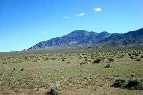
The range is linear, with a high peaks section in the southwest; the northeast lower elevation foothills merge into the Cricket Mountains. A smaller, almost circular mountain sub-range is attached on the southeast, the Beaver Lake Mountains, which is also adjacent to the town of Milford; the Beaver River flows north through Milford Valley and enters the desert region east of the mountain ranges. (When flowing above ground, the river intersects with the Sevier River, to the north, and before entering Sevier Lake.)
A ridgeline of the range occurs in the south, and is slightly west of center; and south of the range's center and on the ridgeline is the range highpoint, Frisco Peak, 9,660 feet (2,944 m).[1]
See also
References
- ↑ Utah, DeLorme Atlas & Gazetteer, p. 40-41.
External links
 Media related to San Francisco Mountains (Utah) at Wikimedia Commons
- Frisco Peak, summitpost (coordinates)