San Juan Chamelco
| San Juan Chamelco | |
|---|---|
| Municipality | |
 San Juan Chamelco Location in Guatemala | |
| Coordinates: 15°25′32.430″N 90°19′34.626″W / 15.42567500°N 90.32628500°WCoordinates: 15°25′32.430″N 90°19′34.626″W / 15.42567500°N 90.32628500°W | |
| Country |
|
| Department |
|
| Municipality | San Juan Chamelco |
| Government | |
| • Type | Municipal |
| Population | |
| • Ethnicities | Q'eqchi', Ladino |
| • Religions | Roman Catholicism, Evangelicalism, Maya |
| Climate | Cfb |
San Juan Chamelco is a municipality in the Guatemalan department of Alta Verapaz. It is situated at 1350 m above sea level. It covers a terrain of 80 km². The annual festival is on June 24.
Climate
San Juan Chamelco has temperate climate (Köppen: Cfb).
| Climate data for San Juan Chamelco | |||||||||||||
|---|---|---|---|---|---|---|---|---|---|---|---|---|---|
| Month | Jan | Feb | Mar | Apr | May | Jun | Jul | Aug | Sep | Oct | Nov | Dec | Year |
| Average high °C (°F) | 20.8 (69.4) |
22.4 (72.3) |
23.8 (74.8) |
24.4 (75.9) |
24.6 (76.3) |
23.9 (75) |
23.1 (73.6) |
23.6 (74.5) |
23.6 (74.5) |
22.7 (72.9) |
21.7 (71.1) |
21.2 (70.2) |
22.98 (73.38) |
| Daily mean °C (°F) | 15.5 (59.9) |
16.6 (61.9) |
17.8 (64) |
18.8 (65.8) |
19.6 (67.3) |
19.7 (67.5) |
19.1 (66.4) |
19.2 (66.6) |
19.2 (66.6) |
18.4 (65.1) |
17.2 (63) |
16.4 (61.5) |
18.13 (64.63) |
| Average low °C (°F) | 10.3 (50.5) |
10.9 (51.6) |
11.9 (53.4) |
13.3 (55.9) |
14.6 (58.3) |
15.5 (59.9) |
15.2 (59.4) |
14.9 (58.8) |
14.9 (58.8) |
14.1 (57.4) |
12.8 (55) |
11.6 (52.9) |
13.33 (55.99) |
| Average precipitation mm (inches) | 105 (4.13) |
72 (2.83) |
91 (3.58) |
83 (3.27) |
158 (6.22) |
286 (11.26) |
254 (10) |
240 (9.45) |
300 (11.81) |
283 (11.14) |
193 (7.6) |
116 (4.57) |
2,181 (85.86) |
| Source: Climate-Data.org[1] | |||||||||||||
Geographic location
San Juan Chamelco is surrounded by Alta Verapaz Department municipalities.[2]
 |
San Pedro Carchá | San Pedro Carchá | | |
| Cobán | |
Senahú[2] | ||
| ||||
| | ||||
| Cobán | Cobán, Tamahú and Tucurú[2] |
See also
References
- ↑ "Climate: San Juan Chamelco". Climate-Data.org. Retrieved 21 August 2015.
- 1 2 3 SEGEPLAN. "Municipios de Alta Verapaz, Guatemala". Secretaría General de Planificación y Programación de la Presidencia de la República (in Spanish). Guatemala. Archived from the original on 30 June 2015. Retrieved 30 June 2015.
External links
Capital: Cobán | ||
| Municipalities | 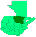 | |
This article is issued from Wikipedia - version of the 4/26/2016. The text is available under the Creative Commons Attribution/Share Alike but additional terms may apply for the media files.