Sandamu
| Sandamu | |
|---|---|
| LGA and town | |
 Sandamu Location in Nigeria | |
| Coordinates: 12°56′N 8°22′E / 12.933°N 8.367°ECoordinates: 12°56′N 8°22′E / 12.933°N 8.367°E | |
| Country |
|
| State | Katsina State |
| LGA | 1996 |
| Government | |
| • Chairman | sani sabo sandamu |
| Area | |
| • Total | 1,418 km2 (547 sq mi) |
| Population (2006 census) | |
| • Total | 137,287 |
| Time zone | WAT (UTC+1) |
| 3-digit postal code prefix | 824 |
| ISO 3166 code | NG.KT.SDM |
Sandamu is a Local Government Area in Katsina State, Nigeria. Its headquarters are in the town of Sandamu on the A2 highway in the north of the area at12°57′37″N 8°21′44″E / 12.96028°N 8.36222°E. it have three traditional districts 1. Sandamu district headed by Alh Zakari Sani Zakari [Bunturawan Daura 2, Fago district headed by Ambasador [Magajin Rafin Daur 3. Rijiyar Tsamiya district headed by Alh Yusuf sani Manzo [Sarkin Fulanin Daura. it comprises Eleven [11] political wards namely, Sandamu, Fago A, Fago B, Rade A, Rade B, Daneji A, Daneji B, katsayal, kagare, karkarku, kwasarawa.
It has an area of 1418 km² and a population of 137,287 at the 2006 census.
The postal code of the area is 824.[1]
References
- ↑ "Post Offices- with map of LGA". NIPOST. Retrieved 2009-10-20.
External links
State capital: Katsina | ||
| LGAs | 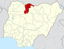 | |
This article is issued from Wikipedia - version of the 12/12/2014. The text is available under the Creative Commons Attribution/Share Alike but additional terms may apply for the media files.