Santa Cruz das Flores
| Santa Cruz das Flores | |||
| Municipality (Concelho) | |||
| Pico da Sé: a rare winter scene in the municipality of Santa Cruz das Flores | |||
|
|||
| Official name: Concelho de Santa Cruz das Flores | |||
| Name origin: Portuguese for Holy Cross of Flores | |||
| Country | |||
|---|---|---|---|
| Autonomous Region | |||
| Island | Flores | ||
| Civil Parishes | Caveira, Cedros, Ponta Delgada, Santa Cruz das Flores | ||
| Center | Santa Cruz das Flores | ||
| - elevation | 35 m (115 ft) | ||
| - coordinates | 39°27′18″N 31°7′53″W / 39.45500°N 31.13139°WCoordinates: 39°27′18″N 31°7′53″W / 39.45500°N 31.13139°W | ||
| Highest point | Morro Alto | ||
| - location | Pico da Burrinha | ||
| - elevation | 911 m (2,989 ft) | ||
| - coordinates | 39°28′0″N 31°13′38″W / 39.46667°N 31.22722°W | ||
| Lowest point | Sea level | ||
| - location | Atlantic Ocean | ||
| - elevation | 0 m (0 ft) | ||
| Area | 70.91 km2 (27 sq mi) | ||
| - water | .62 km2 (0 sq mi) | ||
| - urban | 1.43 km2 (1 sq mi) | ||
| Population | 2,289 (2011) | ||
| Density | 32/km2 (83/sq mi) | ||
| Settlement | c.1548 | ||
| - Municipality | c.1895 | ||
| LAU | Câmara Municipal | ||
| - location | Rua Senador André de Freitas | ||
| - elevation | 24 m (79 ft) | ||
| - coordinates | 39°27′12.72″N 31°7′40.82″W / 39.4535333°N 31.1280056°W | ||
| President | Manuel Alberto da Silva Pereira (PS) | ||
| Municipal Chair | Maria da Graça Silveira Armas Camacho (PS) | ||
| Timezone | Azores (UTC-1) | ||
| - summer (DST) | Azores (UTC0) | ||
| Postal Zone | 9970 | ||
| Area Code & Prefix | (+351) 292 XXX-XXXX | ||
| Demonym | Santa-cruzenses | ||
| Patron Saint | Nossa Senhora da Conceição | ||
| Municipal Holidays | 24 June (São João) | ||
 Location of the municipality of Santa Cruz das Flores in the archipelago of the Azores | |||
| Wikimedia Commons: Santa Cruz das Flores | |||
| Website: http://cm-santacruzdasflores.azoresdigital.pt/ | |||
Santa Cruz das Flores (Portuguese pronunciation: [ˈsɐ̃tɐ ˈkɾuʒ ðɐʃ ˈfloɾɨʃ]) is a municipality in Portugal, located across from the island of Corvo on the island of Flores, in the western part of the autonomous region of Azores. The population in 2011 was 2,289,[1] in an area of 70.91 km².[2] It occupies the northern half of the island. It is surrounded by the Atlantic Ocean on all sides except south, where it borders Lajes das Flores.
History

The earliest record of the northern municipality referred to the village of Santa Cruz das Flores, in 1548. Transcribing the works of Father [Gaspar Frutuoso], Francisco Gomes documented the arrival of the crew of the nau Nossa Senhor da Misericórida. He included Gaspar Frutuoso's 1589 reference, described the growing urban area of Santa Cruz as a "well divided and plane villa" covered in thatched roofs. Ponta Delgada, he continued, was a parish of 30 neighbours surrounding its small hermitage (dedicated to Santo Amaro, even as its ecclesiastical patron since the 16th century was the apostle Peter).
In the beginning of the 17th-Century Diogo das Chagas, referred to the villa of Santa Cruz as the "head of the island" and the center of the administration, noting "[the village]...is very well located with the best port on the island...". He described his hometown as built on "firm foundations", delimited by its interlocking roads that began at the Santa Cruz sandbar and the other the port of Poças, all in the direction of Monte Calvário (today, Monte das Cruzes). He described "...the first road of the village and from the Porto das Poças another road, which is the last in the village, and where the rest of the roads intersect...". This year marked the municipal administration of the northern half of the island; part of the administrative regalia, was the obligatory construction of a lighthouse.
A primitive church, dating to the 16th century and constructed in 1627, by vicar Inácio Coelho, who in 1641 also provided land for the founding of the Franciscan Convent of São Boaventura, as well as the bread and wine for religious ceremonies.
By the end of 1693, Friar Agostinho de Mont'Alverne, referred to 9000 inhabitants, living in 180 homes, primarily in the village of Santa Cruz. These original settlers were Portuguese, primarily from the area of the Alentejo and Minho. It was about this time that the third oldest of the parishes was created by the Diocese in Angra, on 9 July 1693: Nossa Senhora do Pilar, delimited by the ravines of Barrosas (in the north) and Alagoa (in the south). The two localities that formed the parish, Cedros and Ponta Ruiva, deannexed from the parishes of São Pedro de Ponta Delgada and the Matriz de Nossa Senhora da Conceição, in Santa Cruz, included 50 homes and 176 people. With its prebystery and image of it patron saint provided by the Count of Santa Cruz, its primitive parochial church was later expanded in 1719 and reconstructed in 1822.
By 1717, Father António Corderio described a population of over 200 homes, on a plain surface, well constructed, with four roads that lead to the sea, cut by various lanes. Many of its roads were marked by iconic buildings, including the hermitage of St. Peter and main parochial church (which continued to be constructed and reconstructed into the 18th century), in addition to the hermitages of São Sebastião, Santa Catarina, and the Franciscan Convent of São Boaventura (founded in 1641 by father Inácio Coelho).
The parochial church of Ponta Delgada resulted from the reconstruction of the old hermitage, around 1763, under the initiative of Father Francisco de Fraga e Almeida. Initially, the parish also included the areas of Ponta and Ponta Ruiva, but which were later deannexed to form the parishes of the Fajãs (in 1676) and Nossa Senhora do Pilar (in 1693), respectively. About the same time, José António de Sousa Bettencourt, a natural and property-owner from the island of Graciosa, began constructing a hermitage in the area of Caveira, that was consecrated on 22 December 1763, to the invocation of the Sainted Souls of the Flames of Purgatory (Portuguese: Almas Santas do Fogo do Purgatório). At the time, the inhabitants (numbering about 100 in 32 homes) were subject to the "spiritual and corporal convenience" of the parish of São Caetano in Lomba, since July 1757. Unfortunately, this parish operated in the neighbouring municipality of Lajes, and the parishioners were required to trek the distance for services between valleys. This continued until 1833 and 1834, when the little settlement of Caveira was transformed into a parish, thereby obtaining the patron of Benditas Almas (Blessed Souls), from 1954 on the invocation of Nossa Senhora do Livramento (Our Lady of Freedom)).
Santa Cruz, around 1815, had already developed into a beautiful city, all but in name. But, as the old eclessiastical ouvidor José António Camões observed, its principal roadways (Rua das Poças, Rua do Rego, Rua de Santa Catarina, Rua do Porto, Rua Nova and Rua de São Sebastião do Moio) and various lanes were irregular, as too were its buildings. Of the 429 buildings registered by the local administration, only 113 were covered by standard shingles of the period. Of the 419 people that inhabited the areas of Ribeira dos Barqueiros, Vales, Pampilhal, Fazenda and Além da Ribeira (there were no records for the centre of town), no one person used footwear. Poverty was a general condition, and the Donatários of the island (first the Fonsecas, later the Counts of Santa Cruz and finally Pedro José Caupers) subjugated the populous as serfs. The Crown had bestowed the lands, politico-military institutions and clergy for the islanders, but neglected the socio-political institutions that relegated, as Father Camões described: ...the inhabitants of the island of Flores [as the]...most poor and miserable of the universe (except for the Corvinos).
The cornerstone of the parochial church of Caveira was placed on 13 June 1870, and its construction was completed on 11 September 1880, with the consecration of the altar.
Since 7 January 1841, the villa of Santa Cruz, was the judicial center for the dual-administration of Flores and Corvo (the Western archipelago); the justice system was handled from Santa Cruz, although a magistrate came from off-island. Santa Cruz grew and quickly surpassed Lajes demographically and in its economic position, finally coopting the politics in the two islands in 1895. On the 18 November of that year, the municipality of Lajes was made redundant, and along with Corvo, it became an integrated municipality from 1895 to about 1898. In 1898, the counsel José Luciano de Castro undertook the restoration of the individual administrative divisions.
Alleging problems with the firmness of its lateral walls, the parochial church of Cedros was demolished in September 1945, and a new temple constructed: it was consecrated on 18 June 1954.
Geography
.jpg)

Physical geography
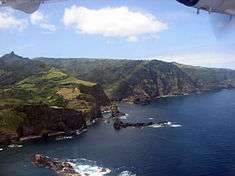
As part of a volcanic island, the municipality of Santa Cruz das Flores offers several scenic vistas, with extinct volcanic cones and lakes in an area generally rugged. It is a natural garden, whose principal activities includes floral-culture and the ubiquitous Azorean dairy industries. The only significantly level ground is occupied by its primary center, Santa Cruz das Flores (parish), located on the eastern coast and near the municipal border with Lajes das Flores. Apart from a commercial center, it is the home of the island's only airport and secondary school.
To the north, along the only roadway, is the hamlet of Fazenda de Santa Cruz, noted for its Forest Reserve (Reserva Florestal da Fazenda de Santa Cruz), artificial lake and the island's only electrical station (constructed in 1967). The park is home to a small spawning program for trout, provides sites for picnicking, location of deer pens and an abundance of endemic plant species.
At the end of the Regional Road is the community of Ponta Delgada a coastal community with a line of sight to Corvo, as well as many sheltered coves and bays. The Gruta dos Encharéus (an enormous coastal grotto 50 meters long by 25 wide), the Gruta do Galo, the islets of Maria Vaz, Cartário, Abrões, Muda, Pão de Açúcar and Furado, as well as the plains of Ponta Delgada, Moinho and Vermelha, among others, are natural symbols of the coast of this municipality.
Ecoregions/Protected areas
The western and interior parts of the municipality are largely vacant of inhabitants and unspoiled by development, partly responsible for the island's biodiversity being recognized by UNESCO (May 26, 2000). Many of the islands natural resources are located in this region, which includes Morro Alto (the highest point in the municipality and island at 915 meters) and the following natural sites of community interest:
- Reserva Florestal de Recreio Luís Paulo Camacho[3][4] (English: Luís Paulo Camacho Recreational Forest Reserve)
- Reserva Florestal Natural da Caldeira Funda (English: Caldeira Funda Natural Forest Reserve)
- Reserva Florestal Natural da Caldeira Rasa (English: Caldeira Rasa Natural Forest Reserve)
- Reserva Florestal Natural do Morro Alto e Pico do Sé (English: Morro Alto and Pico do Sé Natural Forest Reserve)
In addition to the Forest Reserves, the municipality is bisected by a series of pedestrian hiking trails, that skirt the coastal areas and the interior. These trails, at many levels of endurance, include trips that cover: Ponta Delgada, Cedros, Ponta Ruiva, the village of Santa Cruz, Fazenda, Monte, Vales, Ribeira dos Barqueiros and even the smaller parish of Caveira.[5]
Climate
Santiago des Flores has a humid subtropical climate (Cfa) as the warmest month mean is just at 22.8 °C. It has the highest rainfall of all the Azores’ islands and owing to the influence of the Gulf Stream the mildest winters of any place so far from the equator. However, the warm Gulf Stream waters mean rain falls on two-thirds of all days during the year and humidity averages around 80 percent.
| Climate data for Santa Cruz das Flores, Azores | |||||||||||||
|---|---|---|---|---|---|---|---|---|---|---|---|---|---|
| Month | Jan | Feb | Mar | Apr | May | Jun | Jul | Aug | Sep | Oct | Nov | Dec | Year |
| Record high °C (°F) | 21.1 (70) |
21.0 (69.8) |
21.8 (71.2) |
22.5 (72.5) |
25.3 (77.5) |
26.9 (80.4) |
29.8 (85.6) |
30.4 (86.7) |
29.6 (85.3) |
26.6 (79.9) |
25.0 (77) |
23.1 (73.6) |
30.4 (86.7) |
| Average high °C (°F) | 17.0 (62.6) |
16.7 (62.1) |
17.1 (62.8) |
18.0 (64.4) |
19.5 (67.1) |
21.8 (71.2) |
24.6 (76.3) |
25.7 (78.3) |
24.4 (75.9) |
21.8 (71.2) |
19.3 (66.7) |
17.8 (64) |
20.31 (68.55) |
| Daily mean °C (°F) | 14.5 (58.1) |
14.1 (57.4) |
14.6 (58.3) |
15.4 (59.7) |
16.9 (62.4) |
19.0 (66.2) |
21.7 (71.1) |
22.8 (73) |
21.6 (70.9) |
19.2 (66.6) |
16.9 (62.4) |
15.3 (59.5) |
17.67 (63.8) |
| Average low °C (°F) | 11.9 (53.4) |
11.5 (52.7) |
12.0 (53.6) |
12.7 (54.9) |
14.2 (57.6) |
16.2 (61.2) |
18.8 (65.8) |
19.8 (67.6) |
18.8 (65.8) |
16.5 (61.7) |
14.4 (57.9) |
12.8 (55) |
14.97 (58.93) |
| Record low °C (°F) | 2.1 (35.8) |
4.0 (39.2) |
3.4 (38.1) |
5.0 (41) |
9.0 (48.2) |
9.2 (48.6) |
11.4 (52.5) |
13.8 (56.8) |
11.4 (52.5) |
9.1 (48.4) |
6.5 (43.7) |
5.4 (41.7) |
2.1 (35.8) |
| Average rainfall mm (inches) | 197.1 (7.76) |
171.3 (6.744) |
155.0 (6.102) |
104.4 (4.11) |
105.6 (4.157) |
97.3 (3.831) |
60.6 (2.386) |
68.0 (2.677) |
123.9 (4.878) |
179.5 (7.067) |
179.6 (7.071) |
223.9 (8.815) |
1,666.2 (65.598) |
| Average rainy days (≥ 0.1 mm) | 23.9 | 22.0 | 21.1 | 18.6 | 18.6 | 15.7 | 15.0 | 16.4 | 19.7 | 21.9 | 22.1 | 24.7 | 239.7 |
| Average relative humidity (%) | 80 | 80 | 80 | 80 | 81 | 82 | 81 | 80 | 81 | 79 | 79 | 80 | 80 |
| Mean monthly sunshine hours | 62.0 | 73.5 | 93.0 | 117.0 | 133.3 | 162.0 | 182.9 | 189.1 | 147.0 | 102.3 | 75.0 | 55.8 | 1,392.9 |
| Mean daily sunshine hours | 2.0 | 2.6 | 3.0 | 3.9 | 4.3 | 5.4 | 5.9 | 6.1 | 4.9 | 3.3 | 2.5 | 1.8 | 3.8 |
| Source #1: Instituto de Meteorologia [6] | |||||||||||||
| Source #2: Deutscher Wetterdienst (sun and humidity 1921–1950)[7] | |||||||||||||
Human Geography

|
|
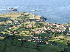
Situated on the maritime coast, the urbanized area is situated on plateau demarcated by a western cliff and the main airport, and surrounded on its western edge by agricultural fields.
The municipality is administered by four civil parishes (Portuguese: freguesias) that include:
- Caveira - the smallest parish in size, bordering Lajes das Flores, with less than 100 inhabitants;
- Cedros - the "middle" parish that straddles the river-valleys of Alagoa Bay and historical location of orchards owing to its micro-climate;
- Ponta Delgada - third-largest community on the island, located along the northern coast;
- Santa Cruz das Flores - municipal seat, location of the airport and largest population (less than 2000 inhabitants.
Although the population of the municipality has remained relatively stable, it has seen a slow decrease over the years.
Since 2006, the local municipal government has developed many infrastructures, re-qualified many existing buildings, roads and improved the accessibility of existing localities. This included many improvements and expansion of roadways, provision of electrical, water and sanitary services, as well as the construction of new subdivisions (such as the Loteamento da Terça) and beautification programs.[8]
Architecture
Civic
- Lighthouse of Ponta do Albernaz (Portuguese: Farol da Ponta do Albernaz), inaugurated on 28 January 1925 as part of the Plano Geral de Alumiamento e Balizagem (General Illumination and Nautical Signalling Plan) for the northern coast of Flores, with the intent of providing a beacon for shipping passing through the Flores-Corvo;[9]
- Municipal Library of Santa Cruz das Flores (Portuguese: Biblioteca Municipal de Santa Cruz das Flores)
- Museum Pimental de Mesquita (Portuguese: Casa-Museu Pimentel de Mesquita)
- Whaling Factory of Boqueiro (Portuguese: Fábrica da Baleia do Boqueirão)
Religious
- Church of Benditas Almas (Portuguese: Igreja Paroquial de Caveira/Igreja das Benditas Almas ), around 1767 the first small church, was constructed under the initiative of José António de Sousa Bettencourt (dedicated to the Blessed Souls) on the site of today's cemetery, but the current church (of the same invocation) was only founded in 1867;[10]
- Church of Nossa Senhora da Conceição (Portuguese: Igreja de Nossa Senhora da Conceição)
- Church of Nossa Senhora do Livramento (Portuguese: Igreja de Nossa Senhora do Livramento)
- Church of Nossa Senhora de Lourdes (Portuguese: Igreja de Nossa Senhora de Lourdes)
- Church of Nossa Senhora do Pilar (Portuguese: Igreja de Nossa Senhora do Pilar)
- Church of São Pedro (Portuguese: Igreja Paroquial de Ponta Delgada/Igreja de São Pedro), parochial church dedicated to St. Peter, constructed in 1763 and remodeled during the latter part of the 20th Century;[11]
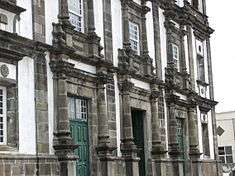
- Convent of São Boaventura (Portuguese: Igreja e claustro do Convento Franciscano de São Boaventura), today home to the Museum of Flores, the Franciscan convent was built under the initiative of Inácio Coelho, then vicar of Santa Cruz.[12] It is suggested that this church was originally conceived in fulfillment of a vow following the triumph of Portuguese forces over Spain during the Restoration War.[12]
References
- Notes
- ↑ Instituto Nacional de Estatística
- ↑ Eurostat
- ↑ Reserva Florestal de Recreio Luís Paulo Camacho Pamphlet (Portuguese) for the Recreational Forest Reserve.
- ↑ In 2002, this name was adopted by the Regional Government, to replace the more ambiguous Reserva Florestal Natural da Fazenda de Santa Cruz (English: Fazenda de Santa Cruz Forest Reserve) in Legislative Decree No. 16/1989 (August 30).
- ↑ Itinerários Pedestres do Concelho Pamphlet (Portuguese) of the Hiking Trails.
- ↑ "Normais climatológicas 1981-2010>Flores". Instituto de Meteorologia. Retrieved 23 August 2012.
- ↑ "Klimatafel von Santa Cruz / Insel Flores; Azoren / Portugal" (PDF). Baseline climate means (1961-1990) from stations all over the world (in German). Deutscher Wetterdienst. Retrieved 30 January 2016.
- ↑ Câmara Municipal de Santa Cruz das Flores (January 2007), p.2-11
- ↑ Costa, Patrícia (2002), SIPA, ed., Casa Pimentel de Mesquita (IPA.00012776/PT072006030004) (in Portuguese), Lisbon, Portugal: SIPA – Sistema de Informação para o Património Arquitectónico, retrieved 29 March 2014
- ↑ Noé, Paula (2011), SIPA, ed., Igreja Paroquial de Caveira/Igreja das Benditas Almas (IPA.00032452/PT072006010009) (in Portuguese), Lisbon, Portugal: SIPA – Sistema de Informação para o Património Arquitectónico, retrieved 29 March 2014
- ↑ Noé, Paula (2011), SIPA, ed., Igreja Paroquial de Ponta Delgada/Igreja de São Pedro (IPA.00032454/PT072006030011) (in Portuguese), Lisbon, Portugal: SIPA – Sistema de Informação para o Património Arquitectónico, retrieved 29 March 2014
- 1 2 Noé, Paula (2002), SIPA, ed., Igreja e claustro do Convento Franciscano de São Boaventura (IPA.00008193/PT072006040001) (in Portuguese), Lisbon, Portugal: SIPA – Sistema de Informação para o Património Arquitectónico, retrieved 6 October 2013
- Sources
- Regional Legislative Assembly of the Azores (1989). "Decreto Legislativo Regional N.º 16/1989/A de 30 de Agosto" (in Portuguese). Ponta Delgada, Azores: Jornal Oficial: Presidência do Governo dos Açores.
- Câmara Municipal (January 2007). "Boletim Autárquico" [Local Government Bulletin] (in Portuguese). Santa Cruz das Flores, Azores: Câmara Municipal da Santa Cruz das Flores.
- Arruda, Manuel Monteiro Velho (1932), Documentos Relativos ao Descobrimento dos Açores (in Portuguese), Ponta Delgada (Azores), Portugal: Oficina de Artes Gráficas
- Brandão, Raul, As Ilhas Desconhecidas, Perspectivas & Realidades (in Portuguese), Lisbon, Portugal
- Chagas, Diogo das (1989), Espelho Cristalino em Jardim de Várias Flores (in Portuguese), Ponta Delgada (Azores), Portugal: Secretaria Regional da Educação e Cultura/Universidade dos Açores
- Cordeiro, António (1717), História Insulana das Ilhas a Portugal Sugeytas no Oceano Occidental (in Portuguese), Lisbon, Portugal: SREC (1981)
- Cortesão, Jaime (1966), Os Descobrimentos Pré-Colombinos dos Portugueses, Portugália (in Portuguese), Lisbon, Portugal
- Frutuoso, Gaspar (1963), Saudades da Terra, Livro VI (in Portuguese), Ponta Delgada (Azores), Portugal: Instituto Cultural de Ponta Delgada
- Gomes, Francisco António Nunes Pimentel (2003), A Ilha das Flores: da redescoberta à actualidade (Subsídios para a sua História) (in Portuguese), Lajes das Flores (Azores), Portugal: Câmara Municipal de Lajes das Flores
- Leite, José Guilherme Reis (1993), "Um retrato da Ilha das Flores no final do Antigo Regime. A memória do padre José António Camões", Boletim do Instituto Histórico da Ilha Terceira (in Portuguese) (XLVIII), Angra do Heroísmo (Azores), Portugal
- Menezes, Avelino de Freitas (2007), "Discurso de Encerramento", O Faial e a Periferia Açoriana nos séculos XV a XX. Actas do IV Colóquio (in Portuguese), Horta (Azores), Portugal: Núcleo Cultural da Horta
- Monteiro, Paulo (18 January 2008), Batalhas e Naufrágios nos Açores (1591) (in Portuguese)
- Riley, Carlos Guilherme (1993–95), "Uma Fronteira Ocidental. As Flores e o Corvo no Contexto das rotas atlânticas", Boletim do Núcleo Cultural da Horta (in Portuguese), XI
- Silva Cravinho, Luís Miguel da (2007). "Santa Cruz das Flores: Itinerários Pedestres do Concelho" [Santa Cruz das Flores: Municipality Pedestrian Itineraries] (PDF) (in Portuguese). Santa Cruz das Flores, Azores: Câmara Municipal de Santa Cruz das Flores.
- Silveira, Pedro da (November 1960), "Para a História do Povoamento das Ilhas das Flores e do Corvo", Boletim do Núcleo Cultural da Horta (in Portuguese), II (2), Horta (Azores), Portugal
- Sousa, João Teixeira Soares de (1920), Os Silveiras dos Açores (in Portuguese), Calheta (Azores), Portugal: Minerva Calhetense

