Sautee Nacoochee, Georgia
| Sautee Nacoochee | |
|---|---|
| Unincorporated community | |
 | |
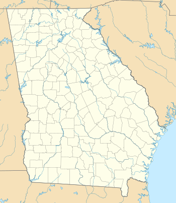 Sautee Nacoochee Location within the state of Georgia | |
| Coordinates: 34°40′48″N 83°40′51″W / 34.68000°N 83.68083°WCoordinates: 34°40′48″N 83°40′51″W / 34.68000°N 83.68083°W | |
| Country | United States |
| State | Georgia |
| County | White |
| Time zone | Eastern (EST) (UTC-5) |
| • Summer (DST) | EDT (UTC-4) |
Sautee Nacoochee (or Sautee-Nacoochee) is an unincorporated community in White County, Georgia, near Sautee Creek in the Appalachian foothills of northeast Georgia, approximately 95 miles (153 km) north of Atlanta. The nearest incorporated town is the tourist destination of Helen, Georgia.
Geography
Sautee Nacoochee is located at longitude -83.68094,latitude 34.67994.
Origin of names
Sautee Nacoochee's name combines two place names of Muscogee origin. Sautee is the Anglicization of a branch of the Creek Native Americans, known as the Sawate, which means "Raccoon People." Nacoochee is the Anglicization of the Cherokee pronunciation of the Creek word, Nokose, which means "bear."[1]
A state historic marker states that the location was visited by Hernando de Soto in 1540 AD. However, a study of the route taken by De Soto by a team of Southeastern university professors in the 1980s placed his route far to the north.[2]
In 1646, the Governor of Spanish Florida ordered the construction of a trading post on the Chattahoochee River, somewhere in the vicinity of Sautee-Nacoochee. The 1693 Map of North America by Robert Morden labels Sautee as "Apalache." This may be the name of a Spanish gold mining village, because the 1721 Map of South Carolina, drawn by Colonel John Barnwell, names the Native American village at that location, Itsate. The Itsate were a branch of the Creek Indians that today are commonly called Hitchiti. Apparently, the valley was soon captured by the Cherokees, because subsequent maps of the Cherokee Nation show the village being named Chote, Chotee or Chota.[3] In 1754, all Cherokee villages were burned in northeast Georgia by the Koweta Creeks in their successful campaign to end the 40 year long Creek-Cherokee War. The 1755 map of North America by John Mitchell labels all Cherokee villages in the northeast tip of Georgia and extreme western North Carolina as being "deserted." The site was reoccupied by Native Americans after the American Revolution, but oddly the small village had a Creek name of Sawate, sometimes called "Santee." The land that village sat on was sold in 1722 to families from Burke County, NC and thereafter ceased to be occupied by Native Americans.
The village of Nacoochee was located to the east of Chota, near the foot of Alec Mountain on the Unicoi Trail. The Nacoochee Valley is known for the Nacoochee Indian Mound, at the northwestern end of the valley, which was constructed between 700-1200 AD.
Nearby Yonah Mountain is the site of a folktale where a beautiful Cherokee maiden named Nacoochee fell in love with the Chickasaw warrior Sautee. When their love was forbidden by the tribal elders, a war party followed the eloping lovers and threw Sautee off the mountain, with Nacoochee then jumping to her death, a Lover's Leap. Although he did not invent the legend, George Williams, the son of one of the original white settlers, popularized it in his 1871 Sketches of Travel in the Old and New World.[4]
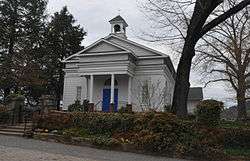
Sautee Valley Historic District
|
Sautee Valley Historic District | |
 | |
 | |
| Location | GA 255 and Lynch Mountain Rd., Sautee, Georgia |
|---|---|
| Coordinates | 34°41′54″N 83°39′52″W / 34.69833°N 83.66444°W |
| Area | 1,000 acres (400 ha) |
| NRHP Reference # | 86002742[5] |
| Added to NRHP | August 20, 1986 |
The Sautee Valley Historic District (also known as the Nacoochee Valley Historic District) is a historic district centered on the community of Sautee Nacoochee. It was added to the National Register of Historic Places in 1986 and has agricultural, architectural, and historic significance. The District includes the location of pre-historic villages and more recent buildings and structures from after American settlers came to the area. Spanish explorers sought gold in this valley, as did settlers who were seeking their fortune in the Georgia Gold Rush. The center point of the Sautee Valley Historic District is the intersection of Georgia State Route 255 and Lynch Mountain Road.
Sautee Nacoochee Center
Sautee Nacoochee is most noted for the Sautee Nacoochee Center, a cultural and community center housed in the restored Nacoochee schoolhouse. The center was founded by the Sautee-Nacoochee Community Association (SNCA), which was also responsible for getting both Sautee and Nacoochee Valleys placed on the National Register of Historic Places.
In September 2006, the Folk Pottery Museum of Northeast Georgia opened on the grounds of the Sautee Nacoochee Center. The Pottery Museum’s new facility, designed by Atlanta architect Robert M. Cain, features a 3,200-square-foot (300 m2) main exhibit floor that houses more than 150 vessels on permanent display and has space for additional temporary exhibits.
The numerous cultural programs at the Sautee Nacoochee Center led to Sautee Nacoochee being designated as one of "The 100 Best Small Arts Towns in America" in a book by the same name written by John Villani.
See also
Nearby towns
Resources
- 2005 In the Shadow of Yonah: A History of White County, Georgia. Garrison Baker, Brasstown Creek Publications, Cleveland, GA.
References
- ↑ Martin, Jack & Mauldin, Margaret (2000) A Dictionary of Creek/Muskogee. Lincoln: University of Nebraska Press; p. 82.
- ↑ Knight, Clayton, et al. (1993) The De Soto Chronicles. Tuscaloosa: University of Alabama Press; p. 85.
- ↑ Herbert, John (1725) Map of His Magistie's Province of South Carolina.
- ↑ Farmer, Jared (2008). On Zion's Mount: Mormons, Indians, and the American Landscape. Harvard University Press. p. 313. ISBN 978-0674027671.
- ↑ National Park Service (2009-03-13). "National Register Information System". National Register of Historic Places. National Park Service.
External links
- Images from the Nacoochee Valley
- Sautee Nacoochee Center
- Folk Pottery Museum of Northeast Georgia
- Sautee Nacoochee Valleys Associations
- National Register of Historical Places.
- Nacoochee Valley State Historical Marker