Schwarzbach (Blies)
| Schwarzbach | |
|---|---|
 The Schwarzbach in Zweibrücken | |
| Country | Germany |
| Basin | |
| Main source |
Palatinate Forest 500 m (1,600 ft) |
| River mouth |
Confluence with Blies near Einöd 220 m (720 ft) 49°15′55″N 7°18′26″E / 49.26528°N 7.30722°ECoordinates: 49°15′55″N 7°18′26″E / 49.26528°N 7.30722°E |
| Progression | Blies → Saar → Moselle → Rhine → North Sea |
| River system | Rhine |
| Basin size | 1,151 km2 (444 sq mi) |
| Physical characteristics | |
| Length | 50 km (31 mi) |
| Discharge |
|
| Features | |
| Tributaries | |
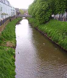
The Schwarzbach is a river in southwestern Germany, left tributary of the Blies. Its source is in the Palatinate Forest, near Trippstadt. It flows through the states Rhineland-Palatinate and Saarland. Towns along its course are Waldfischbach-Burgalben, Contwig and Zweibrücken. After 50 km, it flows into the Blies in Homburg-Einöd.
Tributaries and course
The two headwaters of the Schwarzbach, the first 16 km of which is also known as Burgalb, rise on western side of the watershed in the middle of the Palatinate Forest, just south of the hamlet Johanniskreuz, at an altitude of about 500 m. One spring is located on the southern slope of the 528 m high Mount Steinberg. The other spring is three kilometers away, on the southwest side of the 609m high Mount Eschkopf. The two headwaters meet after about 4 km.
The river then flows past Leimen into the Schwarzbach valley. It takes up the Hundsbächel and the Dinkelsbächel from the right and the Rauschenbach from the left, before reaching the Clausensee reservoir. Then it flows to Waldfischbach-Burgalben, where, where it takes up the Moosalb from the right. At the hamlet of Biebermühle, it takes up the Rodalb from the left, then flows to Thaleischweiler-Fröschen. Below this twin village, it takes up the Wallhalb from the right. It then flows past Rieschweiler-Mühlbach to Dellfield, where the Schwarzbach valley ends and the river flows into the Blies valley. It flows past Contwig to Zweibrücken, where it takes up the Wiesbach from the right, followed by the Hornbach from the left. It then flows across the state line into Saarland and into the Blies in Einöd, a district of Homburg, which in turn flows into the Saar 55 km further downstream.
At the confluence, the Schwarzbach carries twice as much water as the Blies (10.4 m³/s versus 5 m³/s). It is also some 10 percent longer. Since the Blies in turn carries slightly more water than the Saar,[1] it could be argued that hydrologically speaking, the Schwarzbach is the main headwater of the Saar river system.
Tourism
Part of the central Schwarzbach is followed by the German Shoe Road. This holiday route was established in 1977 in order to commemorate that in the early 19th century the region surrounding Pirmasens was the heart of the German shoe industry.
Gallery
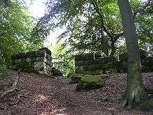 Heidelberg Castle, west gate
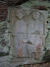 Grave relief of Saltuarius
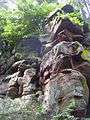 Rock formation at the Heidelberg Castle
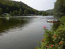 Clausensee viewed to the West (in direction the Schwarzbach flows)
 Schwarzbach valley at Waldfischbach-Burgalben
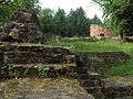 Steinenschloss Castle
External links
| Wikimedia Commons has media related to Schwarzbach (Blies). |
- Walking in the Schwarzbach area: Tour 40, Tour 56, Tour 61
- Water gauge at Contwig
Footnotes
- ↑ Discharge data of the French Saar by the Agence de l'eau Rhin-Meuse